"Old Man On A Bike -- from the Tay Bridge to the Bosphorous Bridge"
- Tim Bugler
- Jul 2, 2025
- 117 min read


IN the early summer of 2024, I decided to mark my 70th birthday, then a few weeks away, by cycling from from Scotland to Istanbul. It has to be said the idea wasn't greeted with wild enthusiasm by my nearest and dearest. My wife, whose advice had always been platinum over many decades, pronounced it "foolhardy, dangerous and exhausting". My son labelled it a "vanity project" and proposed ground rules for stopping at once in a myriad of circumstances. My daughter enjoined me not to go.
I sailed on the North Shields to Amsterdam ferry on May 1st, having left my home in Perthshire a few days earlier. I'd "banked" the Tay-to-the-Forth section a little earlier to save camping only 50 or so miles from home, and to get in another week of work before the final goodbyes, and taking the train past the section I'd already done.
My journey took me across Holland and Germany before picking up the long-distance EuroVelo Route 6, the so-called Danube Cycleway, in Austria. I followed the EV6 for 900 kilometres or so through Slovakia, Hungary, a salami slice of Croatia, and Serbia via Belgrade, to somewhere near Drobeta-Turnu Severin in Romania before picking up EuroVelo Route 13 – a GPX track rather than anything physical -- south through more of Serbia, Bulgaria, and Greece, finally striking east towards the Golden Horn.
I still enjoy my job as a freelance court reporter/photographer, and plan to carry on for a few years yet, but the problem of not retiring is that one doesn't get time to do the things one's always yearned to. The answer is the "sabbatical". In 2023 I awarded myself a month's sabbatical to walk, with a friend, the Camino Frances, a 560 mile pilgrimage from the French Pyrenees to Santiago de Compostela and Finisterre in Spain. In 2025 I plan to follow part of another long-distance cycle route, the EuroVelo 1, from my home to Norkapp in the Arctic Circle, the most northerly point in Europe that can be reached by wheel.
The idea for my first long-distance ride, from the Tay Bridge to the Bosphorous Bridge,came during lockdown in 2020, when it dawned on me that when freedom returned, it needed seizing. Now in the early summer of 2025, I see the clouds of war darkening. I hope all turns out well for the world and long-distance cycle tourists will continue to be able to throw of their shackles, mount their saddles, and pedal to adventure.
My bike is a Claud Butler tourer, which I bought new from the Edinburgh Bicycle Co-op in 1993. Put our ages together and you have fairly antique man-and-machine combination. I prepared The Venerable Claud for our exertions with advice and help from a friend and neighbour, who put his retirement to good use by qualifying as a cycle mechanic. It now has a 32-tooth low ratio on the rear cassette, as opposed to the 28 that was there before (not sure how much difference it really makes), new pedals, new tyres (said to be proof even against snakebites, though not, sadly, against the broken Buckfast bottle I ran over in an underpass on my way to work ), slightly better brakes, and other refinements including a second-hand Garmin navigation device given to me by another, incredibly generous, friend.
For the Istanbul trip I got a rabies jag against the notorious cyclist-chasing canines of eastern Europe, travel insurance (they don't fall over themselves to cover a septuagenarian with added cholesterol who wants to cycle 2300 miles, wild-camping), worked out I didn't need any visas, and considered myself set.
I hope by means of this blog to pass on whatever information I can that may be of use to others. There are many other blogs out there from people whose tyretracks I followed to Istanbul. Harriet and Mat's "Monte and Komodo" blog (monteandkomodo.wordpress.com) is great. My personal favourite is still the first I came across -- Lauren Pears' cheerful account of cycling solo from London to Istanbul in 2019 (www.theplanetedit.com/london-to-istanbul-bicycle-diary/).
I don't cycle “for charity", but when I did the Istanbul trip I wanted to I do to flag up an organisation called The Challenge Hub (www.thechallengehub.org), set up by an old friend, Richard Pertwee. The Challenge Hub was conceived as a sort of Duke of Edinburgh scheme for older people. Sadly, Richard died in May 2025 after a very short and totally unexpected illness, and The Challenge Hub then closed for new registrations. It was a really good idea and I hope someone finds a way to carry on with it, or something similar, where Richard had to leave off.
I recently read Anthony Doerr's All The Light We Cannot See, and was very struck by the phrase that was to become the guiding principal of one of the novel's two protagonists – “Open your eyes and see what you can with them before they close forever”.
So here you go – the blog of my ride from the Tay Bridge to the Bosphorous Bridge:
Day 1: Tay Bridge to Loch Leven – 57 km

Getting a couple of days "in the bank" before setting off properly... Intended to cycle today from the Tay Bridge to the Forth Bridge, but only made it to Kinross due to late start and really nasty April headwind. Also forgot to pump my tyres up properly. The sort of lack of attention to detail that readers of my blog may, sadly, soon become familiar with.
After just half a kilometre, I was held up on the Tay Bridge by roadworks -- was pedaling down the central cycleway when a workman jumped out, pulled a hurdle across, and said I'd have to wait 10 minutes as they were shotblasting. This is high up, mid river, with an icy northwesterly blasting 30 knots. Man says sorry nothing he can do, will just have to wait. Then a young university student pedals up, goes through an impressive repertoire of pleeeeese and freeeeeezing gestures, and we're on our way again in seconds. So glad she turned up! Cycled 49 miles including linking to the bus to and from the start and finish, but only 35 on the actual route.
Day 2: Loch Leven to Musselburgh, Edinburgh - 57 km

A much nicer day than Day 1, due to not cycling in the teeth of a gale. Another 49 miles cycled including to and from my nearest stop for the excellent "Ember" electric bus -- which happily carries bikes. Why aren't all bus companies so enlightened? 35 miles (57 km) on route, including the Roseburn Cycle Path in Edinburgh, currently the subject of controversy because councillors want to turn this former railway line route into a tramway. I can understand why cyclists and runners are annoyed, because it's a wonderful space, but the Edinburgh trams are a great asset. Today's cycling also included the "Innocent Railway" cycle path. The Innocent Railway was a horse-drawn tramway that linked coal pits in Midlothian with Edinburgh. Its half-kilometre St Leonard's Tunnel, built between 1827 and 1830 and quite spooky to ride through, carried the first-ever underground railway line in Scotland.
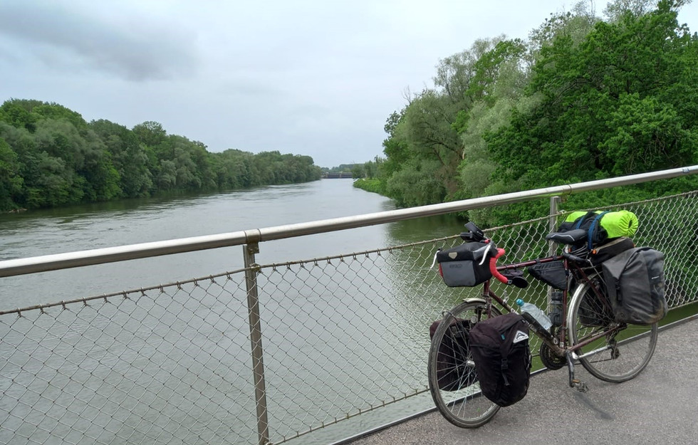
Day 3: Musselburgh to Edrom, Berwickshire (77 k)

Near Abbey Hill, in the Lammermuir Hills, crossing into Berwickshire
Set off from Musselburgh in the afternoon, after a last-morning-at home's inevitable faffing, with the bike now properly loaded with all I hope that I'll need, apart from from food, drink, and refills for the gas cooker, for the next nine to 11 weeks across Europe. A ride beside the Forth, before picking up a speedy cycle track along the old railway line to Haddington, where anyone with common sense would have stopped to buy at least a pint of milk. I didn't. There really is now a dearth of village stores in these click-a-delivery days and I was to rue my decision for the next 70 miles. Then a stunning ride over the Lammermuir Hills, where I was passed by only two cars and a quadbike in nearly two hours on the quiet country roads. Breathtaking views across to England and back towards North Berwick Law and the Bass Rock. Badly running out of steam near Edrom, Berwickshire, I stopped to ask a man and his daughter walking a dog -- the first pedestrians I'd seen for ages, too -- if there was a corner of a field I could camp in. Peter, a farmworker, generously said I could put up my tent at the bottom of his beautiful garden -- more like an orchard really - and after a supper of noodles from my emergency supplies, I slept like a log. Peter even offered to charge my phone for me. So kind.
Day 4 - Edrom to Alnmouth (79k)

Left Peter's garden to the sound of my first cuckoo this year. It was April 29th. Breakfast on the road on coffee I'd made yesterday and oat biscuits home-baked by one of my kind friends before I set off. Great day's ride, accompanied at times by peacock butterflies, stopping at suppertime in Alnwick for a welcome Chinese takeaway and then wild camping in the dunes south of Alnmouth near the village of Lesbury, to the sound of the gulls and the surf. I've since learned that, strictly speaking, this is against the regulations of the National Trust, who own this awe-inspiring stretch of the Northumberland coast, but I follow the rules of "stealth" camping as practised by cyclists and walkers -- pitch at dusk, make no sound, show no light, take the tent down at 6 am, and leave no sign you've been there apart from a bit of flattened grass.
Day 5 - Alnmouth to Newcastle (62k)

Today's ride took me along the Northumberland coast, passing stunning Druridge Bay, where as a young journalist in the very early1980s I covered a thankfully-successful campaign to prevent the Government from erecting a vast Pressurised Water nuclear power station. It would have ruined one of Britain's most beautiful beaches, a "lung" for Tyneside, and an important wildlife habitat. A strong south-easterly headwind took the fun out of the latter sections of today's ride, as did my repeated getting-lost in newish areas of Cramlington, but glad to arrive, sweaty and smelly, in Newcastle where I stayed with old friends, Jane and David. Great ratatouille. Great company. David produced an atlas for me to show them my intended route. After some puzzling -- Serbia mysteriously absent, for example -- we realised it was dated 1982. Things have changed a lot.
Day 6 Newcastle-upon-Tyne to IJmuiden, Netherlands (10k cycling, 726 k by ferry)
After an early lunch left Newcastle's Jesmond, stamping ground of my twenties, for the quick ride down the Coast Road cycleway to the DFDS terminal at North Shields. For all that it's noisy and runs cheek-by-jowl with one of the busiest roads in North East England, this is a model of what a cycleway should be – wide, well surfaced, well signed, well separated from the other traffic, with long, curving, graded overpasses sweeping safely over murderous junctions. Despite the Ven. Claud carrying even more weight due to food and drink for the ferry to avoid ship prices (two Euros for a 300 cl bottle of water!) it took barely more than half an hour. Up the ramp in plenty of time to catch up with some business and do some writing before we sailed and I lost signal.
Day 7 IJmuiden to Utrecht (72 k)

Quiet country lanes near Hilversum. media city of The Netherlands. I had plenty of opportunity to appreciate this one because I got lost and went up and down it three times.
I must remember to drive on the right! Somehow this is easier in a car than on a bike. Main thing to remember – on European roads, danger comes from the left.
After much deliberation and with some sadness I have decided I will probably skip Czechia. I really wanted to see the country, and in particular its monasteries, and also wanted to cut down the number of days crossing Germany, which I'm told is expensive and has an unwelcoming attitude to wild campers (unlike much of Scandinavia, and still, to some extent, Scotland) so I may have to stay a lot on sites. But I think it will be quicker and save money in the long run if I head down towards the Rhine and pick up the cycleroute EuroVelo 15 for a while before cutting across to join EuroVelo 6 – the famous Danube Cycleway – which I will follow all the way to Vienna, Bratislava and Belgrade and through the Iron Gates Gorge to Dobreta Tumu Severin in Romania, before heading south. Incorporating Czechia would also incorporate much tougher gradients, and I'll have more than enough of those when I get to the Rila and Rhodope Mountains in Bulgaria.
Cycling through the centre of Amsterdam, moving with a traffic flow just of bicycles was a fantastic feeling. Eight to 10 miles an hour seems to be the accepted speed. Faster than that and people look put out; slower and you're in the way. I admire the Amsterdamers' style on their sit-up-and-beg machines. The way young women, for example, perform a hand signal – an arm dangled with insouciance, just an elegant fingernail indicating the direction of turn.
Amsterdam is a great city, but I've been there several times before, so this time I swept through. But the canals, the Rijksmuseum, the Van Goch Museum, and Anne Frank's House, a warning of what can happen so quickly when people turn on the Jews, are not to be missed. Also the stroopwafels. I paused for lunch at a street stall called “Istanbul To Go”. Couldn't not, really.
The weather was gorgeous for most of my first day's cycling in Europe itself. Then suddenly near Utrecht the cumulonimbus appeared and I cut short my ride and pedalled for all my might for the nearest campsite. Just as I arrived a massive electrical storm broke. I managed to get the tent up half dry, but the celestial fireworks continued most of the night accompanied by heavy rain and extremely high winds.
The peculiarity of this particular site, by the way, is that there is a man living in the shower block, where he sleeps on a camp bed. Nobody seems to mind, least of all me. He interesting to talk to, knows a lot about engines, has excellent English, and is very clean (as you would expect).
Days 8 and 9, north of Utrecht to Xanten, Germany (147 k, 120 k on route)
My eighth day on the road was dogged by constant rain, temperatures in single figures and a strong head wind, but at least the thunder and lightning had stopped. The Netherlands don't seem well suited for wild camping – what's not marsh is mainly farmed, or has someone's ponies on it – so I had to find a campsite. When I did, near Ede, it was a very nice one, but there was no campsite shop, so had to pedal a 13k round trip to the nearest supermarket for food for supper and milk for breakfast.
Day nine featured some of the nicest cycling so far – down to Arnhem for the fourth photo in our “bridges” series:

The present bridge over the Rhine at Arnhem was opened after the end the of war, and is named in honour of General John Frost, played by Anthony Hopkins in the film “A Bridge Too Far” about the Battle of Arnhem in September 1944.
After crossing the historic structure, I picked up EV15 for the first time, following it down the Rhine towards Xanten, somewhere slipping across an unmarked border into Germany, the fourth country of the trip, if you count Scotland and England as separate countries, which of course I do.
Before that, His Venerability and I had to recross the winding Rhine on the tiny Millingen aan de Rijn - Pannerden ferry, the “slip road” to which (see photo below) we initially and perhaps understandably missed:

We didn't have to wait long for fun the Euros 2.50 crossing, then hell-for-leather (well, my version of hell-for-leather) for Xanten, because the clouds were building after a bright day for what seems to be a habit; starting to pour with rain at 5 pm, just as I'm putting my tent up. Torrential rain went on all night. Went to bed soaked to the skin, with everything I own also soaked, but very happy.
Days 10 and 11, Xanten to Cologne (134 k)

A longish ride of nearly 50 miles on day nine took me from just east of Xanten (attn. pub quizzers! The only town in Germany beginning with an 'X'!) further towards the industrial heart of Germany, but riding by the glorious Rhine you wouldn't know it. For much of the way, the route runs along the top of the flood dykes, busy, it being Sunday, with walkers, local cyclists, families having lunch al-fresco on the grassy slopes, and, near Duisberg, a city of nearly half a million at the junction of the Rhine and Ruhr, people enjoying their cultural traditions sharing shisha pipes set up on the riverside picnic tables and simply watching the boats go by. My own lunch was "punctuated" when a poor chap enjoying a cycle in the sunshine rode by and there was a report like a pistol shot; alarmingly, I saw him swerve to the side and fall off. Investigation revealed his wheel rim had completely collapsed (through wear from the brake pads) and caused a blow-out. There was nothing he or I could do, so he phoned his daughter for rescue.
Arriving at my campsite at Dusseldorf, just by the river. I couldn't help noticing that all the important buildings – the shower block, reception, the laundry room, even the lawnmower shed – were on stilts. My tent, clearly, was going to be at ground level. Trusting the need for stilts to be a winter thing, I slept like a log, and despite being under the flight path of Dusseldorf Airport, actually slept in, being woken at 8.15 am not by the planes but by a group of disputatious jays, living up to their name, Garrulus glandarius.
For day 11, a shorter ride, to get me early into Cologne, where I intend to take a day off to see the sights, and most especially the magnificent 13th centuty cathedral, the tallest twin-spired church in the world, at 515ft, more than twice the height of Scotland's national Wallace Monument. It is the home of the Ark of the Magi, supposed to contain the bones and clothing of the three wise men.
A lateish start, a warm dry morning, and a following wind, took me past a preserved aalshocker, one of special eel-catching boats that fished the Rhine until quite late in the last century. However it wasn't long till the heavens opened again. By the time I pulled into my next campsite, just by the Rhine at Cologne, it was as though I had spent the afternoon being hosed down by a platoon of firemen.
Also planned for my day off -- a bit of bike maintenance. The Ven. Claud's front brake blocks have have completely worn out, and they were replaced new just a week or two before I set off. And not only with new ones, but expensive ones, said to be massively more efficient in the wet. But my guess is they are much softer than cheapos, and though I have a spare packet with me, I think I'll go on the hunt for some tougher ones. Don't want to chafe my rims and end up with an exploding back tyre.
Day 12, Cologne to Bad Breisig (66 km)
Cologne Cathedral was amazing. An extraordinary sight, towering out of the city streets like a mountain had been dropped there. A photo from my phone couldn't do it justice. Inside, never mind the Ark of the Magi, the real treasure is the Crucifix of Giro. Over 1000 years old, it represents Christ neither suffering nor triumphant, but in the very moment of his death. I can't post my photo of it due to Cathedral rules, but it really is a remarkable and extremely moving thing.
I really enjoyed today's ride. My route kept close or next to the Rhine for almost the whole way, and even I find in hard to get lost when all I've got to do is keep the greatest river in Central and Western Europe in sight. Blue EuroVelo 15 signs have started to appear with reasonable frequency. Pottering along on rested legs, mostly through countryside, watching and listening for the boats and the birds, on a day when it didn't rain and with what little wind there was coming from behind me, was wonderful. My route took me past Bonn, but unfortunately on the wrong bank, due to a minor navigational miscalculation, so I had to gaze at Beethoven's birthplace from afar. I then went past the haunting remains of Ludendorf Railway Bridge at Remagen. This was the only bridge captured intact by advancing Allied forces in spring 1945, after German sappers ordered to blow it up botched the job, earning themselves a court-martial. They had, however, weakened it, and it collapsed 10 days later, with the loss of many American lives, but not before a bridgehead had been established on the east bank and a pontoon crossing installed. The bridge towers are now all that remain – those on the west bank are a peace museum, and these on the east bank, which I passed, are semi-ruins:


The east bank towers of Ludendorf Bridge. Readers will spot in the background a hill-- the first I'd seen since sailing from North East England a week earlier.
Day 13, Bad Breisig to Bacharach Am Rhein (87 km)
Staying on my campsite last night were a mum and dad and their five-year-old twins from Canada, who have been cycling together through Europe and Morocco – most of the time camping – since September. It's now May. They're still on their travels, and go back home this September. What an amazing pre-school education is that!
Today my route continued up the Rhine, now slightly but detectably uphill, like cycling on a gentle gradient on a old railway line cycle track. Early lunchtime got me to Koblenz, where the River Mosel (left) joins the Rhine:


Deutsch Eck (German Corner) in Koblenz, where the Mosel joins the Rhine
There was a carnival atmosphere at Deutsch Eck, with cannons being fired from across the Rhine and a holiday mood. Further on when I tried to buy food for supper I found Aldi was closed. I was told that today, May 8th, was VE (Victory in Europe) Day, celebrated in this part of Germany at least, not as the anniversary of their country's defeat but as the anniversary of the day that Nazi rule came to an end.
After passing Loreley Rock, in the Rhine Gorge, where larger boats have to take on a pilot because the passage is so tricky, I arrived at Bacharach Am Rhein, and a campsite on the river for just 10 Euros. No chance of wild camping here – in a narrow gorge lie two main roads and two railway lines, plus the waterway itself, the campsite, and the village, so genuinely quaint it seems like Hogsmeade in Harry Potter:


Bacharach. Between the roofs on the top left you can see vines growing on near-vertical slopes above the village
Day 14, Bacharach to Worms (104 km; 100 on route)


Passing vineyards in the Upper Rhine Plain
The cafe/bakery in Bacharach opened at 6.30 am.
Breakfast sorted, today's ride took me into a new landscape, as I left the Mittelrhein for the Upper Rhine Plain. I passed Rudesheim, a popular destination for Rhine cruise passengers, with the gigantic Niederwalddenkmal, or statue of Germainia, towering on the hillside above it, then through the attractive city of Mainz, where in the 15th century Gutenberg invented the use of “moveable type”, i.e. individual characters that could be set in a frame and printed. As a journalist who has been dependent on print for the majority of my career, I stopped and saluted him with a cup of java. I brought two “luxuries” with me on this trip. One is a Thermos, the other a large moka pot with which to fill it each day.
At one point today I had to turn back for two kilometres to collect something I'd left behind at my lunch spot, and this zippy return, downhill with the wind behind me, confirms why Mike Wells, whose Cicerone Guide to the Rhine Cycle Route I am partly following, chose to detail it starting in the Alps. He recommends it is cycled in that direction, and although of necessity I'm going against the flow, I think that following it from the source to the sea, at Hook of Holland, would make a fantastic three-week holiday.
A lot of today's ride was on dirt tracks and poor surface. .At several points I bumped along on what looked like monoblocks for paving a driveway. A lighter load or wider tyres would have made short work of it, but it was tough work for the Venerable Claude.
Arriving at Oppenheim ready for a rest, I found the campsite there had either closed, or never existed, and unwilling to wild camp with the threat of eye-watering fines in some parts of Germany, I had little option but to pedal on another 31 km to the town of Worms.
This last dash was a fantastic ride – smooth surfaces at last, and, by now, few others on the cycletracks or the country roads. However I couldn't find a campsite in Worms either (there may well be one, but dusk was approaching) so I booked into the convenient and inexpensive Hotel Boos. I really can't afford even inexpensive hotels on such a long trip, however, and I made a note to redouble my research on each coming leg.
Day 15, Worms to Heidelberg (50 km)


Farewell to the Rhine – a last look from Mannheim bridge
After a final 25 km along or near it, today I bade farewell to my fluvial friend for the last 450 kilometres – at Mannheim, I turned firmly east, following the River Neckar, the Rhine's fourth-largest tributary, to Heidelberg, ancient seat of European learning, where, I'm reliably informed, figures of the Scottish Reformation studied and developed ideas. It's a place I've yearned to visit for about 50 years. Tomorrow I shall take my second day off cycling, leave the Ven. Claude grazing, and catch the bus into Heidelberg old town.
It must be said, however, that today's ride, intended to be short and quick, while pleasant enough to Mannheim -- where crossing the Rhine bridge I took the farewell photo seen above -- then became a pain. Coming off the bridge I descended into a spaghetti spill of unsigned ramps, crossings, twists and turns that left me completely bamboozled. It took me 20 minutes – no exaggeration – to extricate myself, and then only by ignoring all the rules, pushing my bike to freedom across an autoroute on-ramp and then through a carpet of broken glass. Honestly by this point I'd have crawled through broken glass on bare knees. The journey then took me up a cycleway between the Neckar and the railway, most of the way to Heidelberg, where the whole getting-lost-in-cities thing started again. My campsite was on the other side of town. Amongst other trials, cyclists are fed into a “cycle priority” lane, perhaps a kilometre long. The idea is that you share the road with motor traffic, which is not permitted to overtake you. In practice I found that cycling a fully-loaded touring bike down a lane with no obvious means of escape while a large Spanish tour coach sat metres off my mudguard was taxing.
Arriving at Camping Heidelberg Fa. Weber, however, made it all seem worthwhile:


A perfect pitch by the River Neckar
Day 17, Heidelberg to Heilbronn (69 kms)
My “day off” visit to Heidelberg's Old Town began with the University library, but its magnificent frontage was covered by scaffolding and plastic sheeting, so I initially walked by. It's an “open access” university library, meaning anyone can use it, and so I did, to research my next stages and charge my phone and laptop. It's a very serious place: not a sound louder than a sniffle from the undergraduates at study. The University's former Student Prison, which I'd loved to have seen, was unfortunately closed (for what were they banged up? Late submission? Plagarism? Coughing in the library?).
I wandered up the baroque gardens of the Schloss, or castle -- which were described as the eighth wonder of the world when they were created by the then Elector of the Rhineland-Palatinate, Frederick V – before visiting the town's Kurpfälzisches museum where for an entrance fee of less than two Euros you can see works by Canaletto and Francesco Guardi. The paintings came into the museum's possession after the death of a local industrialist and collector. On the first floor one is immediately struck by familiar features in a huge oil painting of Frederick V's wife, the Dunfermline-born lass Elizabeth Stuart. Elizabeth was the daughter of Scots king James VI (James I of England) and cousin of England's Queen Elizabeth 1st. It is Elizabeth 1st she so strongly resembles, and after whom she was named. You can't move for Scots in the history of Heidelberg.
Also in the museum is an altar relief from a Roman temple to Mithras, Persian god of the sun, justice, contract, and war, honoured in the Roman Empire, which was found near the river. It is exactly the same as every other Mithraeum altar relief so far found, a remarkable consistency. Finally, I took a stroll up “snake alley” to the Philosophers' Walk, where the university's dons are said to have wandered and disputed.


The Schloss, and Heidelberg's 1788 Alte Brücke (Auld Brig), hundreds of feet, below, seen from the historic Philosophers' Walk on the opposite side of the Neckar. You had to be fit to be a philosopher in those days.
Leaving the campsite, I chatted briefly with man whose touring bike seemed even more heavily laden than mine. How far was he going?, I asked. 120 kilometres came the confident reply. The answer of course is that his cycle was electric. He was heading home to Holland after riding down through France and Spain to the tip of Italy. I wanted to know how he kept his battery charged. “I plug it in,” he replied. I said it was a brief chat. The number of electric bikes in Germany has really surprised me. At one point, I tried counting, and estimated that, leaving aside kids' bikes and serious road bikes, an astonishing 80 per cent were electric. The Ven. Claud need not fear, however. I'm finding it hard enough to keep my phone powered up.
The day's ride was mostly a cruise through woods and fields, watching storks picking for grubs in the recently-cut hay meadows – until I found my route, one of the main 12 “Radnetz” routes in Germany, blocked by ongoing work. “Alle wege gespert” (All ways closed, I think that means) , I was told by the workmen, who then drove off, work no longer ongoing. Where there's a will, however, all ways are not necessarily closed, and no longer being watched, it was not long until my bike and I were on our way again, arriving in time to put the kettle on for afternoon tea at the municipal hostel in Heilbronn.
Day 18, Heilbronn to Schurrenhof (91 kms)
Heilbronn is most famous for its 16th century astronomical clock, on the Rathhaus, or town hall. It chimes the hours, and also announces them by trumpet, rings the quarter hours, and every four hours a mechanical cock crows while mechanical rams lock horns. What a wonderful neighbour it must make.
I must mention the kindness of strangers. It has been unfailing since entering Germany. Here's an example: My hostel was situated, inconveniently for a cyclist, at the top of two flights of stairs in an former shopping centre. No ramps or lifts. When I arrived I unloaded The Venerable Claud at street level, and with the help of the manager, carried bike, five bike bags, and one mattress roll, quickly and efficiently up. In the morning, however, I left before he arrived, and I had been the only resident. I decided to load the bike and wheel it down step by step. I've done this plenty before for short distances, but these stairs, it emerged, were too steep. As I struggled to extricate myself and machine from the consequences of my over-confidence, a bodybuilder materialised from a nearby gym, waved me politely aside, picked the loaded bike, which must weigh nearly 55 kilos when laden with water as well as everything else, and carried it down as if it was a child's trike.


Pausing on a minor road through vineyards
The ride that followed was the first day of consistent hills since I left Scotland. It began upwards through rolling countryside, out of the Neckar valley, through vineyards alive with birdsong. Cornell Lab's free birding app identified the voices Golden Oriole and European Blackcap alongside blackbird and robin. Cuckoos later reappeared. Cutting across from the Rhine catchment to the Danube, I am on a two-day stretch without paper maps, so I plotted my route on a cycling app, drawing a straightish line, taking account of overnight stops. Now, I know there's always a height-and-climb graph, but I had asked the computer for an "all-bikes" cycling route, not a day's Munro-bagging, so I confess I paid little attention to it. I'd also for some reason never heard of the Swabian Jura, also referred to, rather hyperbolically, as the Swabian Alps. Through them I went. The route reached 1925 ft (486 m), through deer-filled forests, with many false summits. At one point the “all bike types” path became so steep and rocky that I could barely push my fully-loaded rig up it, let alone ride it, but as Camus observes in his re-working of the Sisyphus myth, pushing something up a hill, however steep, is actually no punishment, because one gets a rest at the top, a magnificent view, and, if that something is a bike, a exhilarating ride back down. Though I'll have to wait until the next day for most of that, as my overnight stop at Campingplatz Schurrenhof is at nearly 1300 ft.
Day 19, Schurrenhof to Leipheim (60 kms)
The Swabian Jura is separated from the Danube basin by a plain, before another ridge of hills that have to be surmounted before descending to river level. Set in the middle of this plain is the medieval town of Geislingen an der Steige, and after a late start from my campsite, due to a bit of digital nomadism, i.e doing a bit of work from my laptop, it was to here I descended in time for lunch. One should always be on the alert while cycling through towns, and as I passed a car park my nostrils were assailed by the smell of rotisserie chicken. from a van where a man was roasting and selling them. I was tempted but then noticed a small cafe packed with locals offering a “special” for less than seven Euros. Soon I was tucking into roast lamb -- but the rest of what was on my plate remains a mystery I need help with. I know it's only millennials who post pictures of their food, but I'm afraid I'm going to have to, in the hope that someone with knowledge of German transport caff cuisine can enlighten me:


A big chunk of roast lamb and gravy. The stuff that looks like grated cheese is a sort of extruded potato. Or it might be pasta. [Note: I was later told it was “spaetzle”, home-made egg noodles, and a Swabian speciality since medieval times]. On the lettuce is cucumber in a spicy sauce. You'll recognise a quarter tomato. But I've no idea what the yellow stuff was even after eating it. Thought creamed sweetcorn when the chap dished it up but definitely not.
The part of the Geislingen's name “an der Steige”refers to it being “on the climb” of an ancient trade route over the Swabian Jura, and, powered by yellow food, the Ven. Claud and I were soon climbing out of Geislingen via 2.5 kms of narrow road with neither pavement nor cycle path snaking up from the town round five hairpin bends to level off at 2250 ft (from 1400 ft at town level). Now, I know that there's a general feeling that mirrors on a bike are a bit naff, but I put one on the bottom of the left hand drop for this trip and I've never appreciated it so much. Twice when the sound of grounding gears warned me of the approach of something large, a glance in the mirror warned me this one was coming very close and I was able to throw myself and bike almost against the rock face and allow it to safely pass.


After a visit to this viewpoint almost at the top, I'd looked forward to a straightforward downward run, but I'd reckoned without the idiosyncrasies of the navigational app I was using that day that proceeded to direct me 1) down a forest track 2) through the forest where maybe there once was a track but it certainly wasn't there any more and 3) across a field that had just been sprayed with manure. I baulked at that, and found an alternative.
My over-reliance on navigational apps, by the way, is result of not having any kind of paper map for the couple of days' riding cross-country between the Rhine and the Danube. But I finished the day pitching my tent in a little site near Leipheim, Bavaria – a mile and a half from the river I shall be following for over 1200 kilometres to the town of Drobeta-Turnu Severin in Romania. And I have paper strip maps and/or guidebooks the whole way from here to the Greek/Turkish border.
Day 20, Leipheim to Donauworth (69 kms)


My first view of the Danube
I rode up onto the cycle path that runs along the flood dyke of the great river less than 10 minutes after leaving the campsite near Leipheim. This is above the limit of navigation, the river being dammed at several points downstream by weirs connected to hydro-electric power stations. This makes it slow-moving, and home enormous bull-frogs, the size of a childs' fist, each one making a noise like an old-fashioned football rattle. An extraordinary racket.
After a speedy start, the village of Faimingen, Roman Phoebiana, and just off Euro Velo 6, the temple of Apollo Grannus, said to be the largest Roman temple complex yet discovered north of the Alps. The complex at its height is estimated to have covered nearly 100 acres. It has to be said, not much remains:


The remains of the temple of Apollo Grannus
Navigation is now thanks to Mike Wells' Cicerone Guide to the Danube Cycleway, which since I am now going in the direction Wells did (as opposed to the opposite way, which was the case with his guide to the Rhine cycleway) is considerably easier to follow. The route took me through the cobbled streets of the medium-sized town of Dillingen, and past Hochstadt, where the schloss, now a state monument, was used by the Nazis during World War Two to store treasures looted from Ukraine.
Further on, further evidence of man's inhumanity to man – the village of Blenheim, or Blindheim as the Germans have it, scene of the 1704 battle that was such an overwhelming victory for the Duke of Malborough and his Alliance forces that Queen Anne gave him what's now known as Blenheim Palace in Oxfordshire as a performance-related bonus. So many died and were left scattered on the battlefield that farmers here are still ploughing up their bones.
Beyond Blenheim the EV6 bends away from the river for a while to avoid pools and wetland, and continues on very quiet country roads. These narrow tarmac ways have criss-crossed the countryside everywhere I've been so far in Germany. They are characterised, however, by numerous unmarked crossroads, with no signs or lines, and where neither road has priority. Some are hidden, so one is unaware they exist until one is right on them. The potential for cycling right under the wheels of a truck or tractor is obvious, and huge care is needed. The dead-straight ones are the most dangerous of all, because it is so easy just to put one's head down and hammer it. I wonder what the accident statistics show for these roads.
The end of the day brought me into Donauworth, the confluence of the Danube and Wornitz rivers, where I camped at the Kanu Club – for 10 Euros walkers, canoeists and long-distance cyclists are allowed to pitch on their lawn, use their showers and generally make ourselves at home. There's a thunderstorm underway, however, and I write these notes perched on a camping stool sheltering under the canoe shed.
Day 21, Donauworth to Vohburgh (77 kms)

The Venerable Claud Butler on our first bridge crossing of the Danube, at Ingolstadt
After the storm passed last night, a nightingale alighted in the tree just over my tent, and treated me to hours of song. I'm not actually sure I'd ever heard a nightingale sing before, and I was amazed. The range of and sheer beauty of its voice, from perfectly-pitched, soaring melodies to a kid of bass croaking, was extraordinary, and went on and on. All this from a bird only slightly larger than a robin. However – and I realise it is of course churlish to think anything negative about a nightingale – by one in the morning when I was still awake and the bird was still giving it laldy from a perch 10 feet above me, I did wonder when it was going to bed itself. At one point someone in the nearby town even sounded an air-raid siren for some reason – to call out the local volunteer fire brigade or something I suppose – and the nightingale didn't miss a note.
Waking the next morning, I thought I'd fast-forwarded to a late October day back in Scotland. Cold, raining, and blowing hard from the south west. Joyfully I left the comfort of my sleeping bag, for a westerly meant a following breeze, something I hadn't had from the very start! The day's ride began on cycle tracks alongside busy roads across rolling countryside at the edge of the limestone Frankische Alb, and the Venerable Claud sailed ahead of the wind. Outside the Stepperg I paused to consider which of two possible routes would be best, when a man foraging in the hedgerow inquired in German if he could help (I think). I apologised for not understanding, and he switched immediately to impeccable, idiomatic English with barely even a trace of accent. During a 15 minute conversation, he told me of his business trips to Istanbul before he retired, his own cycling through the Alps, and showed me he was collecting elderflowers, for jam, he said. I said in Britain people use them to make elderflower champagne. Coming from a fine, wine-producing country, he thought this was very funny. He then asked me why I was doing this trip on my own. The question took me by surprise. Part of it, obviously, is that is that sleeping in a tent for weeks on end while pedalling slowly from Scotland to Asia is something that will only ever appeal to a smallish minority of people; part of it is the challenge of doing it solo; but mainly it is to do it at my own pace. This nice, clever man also had a good look at my bike. “That's an old-fashioned bike,” he said. “It's venerable,” I replied.
With the weather foul, but at least still coming from behind me, I opted, with some regret, to miss out on a short diversion to the town of Neuberg, where I had wanted to see the 16th century Schlosskappel, the oldest Protestant church in Bavaria, which has a ceiling fresco claimed by proud locals to rival that of the Sistine Chapel, cross a wobbly cycle bridge at Ingolstadt -- my first crossing of the Danube – and head for my night's pitch at the “Rest And Stop Campsite for Canoers and Cyclists|” at Vohburg, provided by the council, and completely free – even the hot showers.
Day 22, Vohburgh to Regensburg (72 kms cycling, 4 kms by ferry)


By ferry through the Donaudurchbruch gorge
Today's section of the EV6 officially includes a 4.5 mile trip down the Danube by boat. At Weltenburg, the river enters a deeply-incised cut in the foothills of the Frankische Alb, too narrow for riverside tracks through the vertical cliffs of the gorge, known as the Donaudurchbruch. So the bike and I boarded a ferry for a fascinating 25-minute trip downriver. Many of the rock formations have fancy names. Napoleon's Suitcase for example (Napoleon III, probably, for they say he left it behind) and a pair of stone pillars called either St Peter and St Paul or Max and Moritz. [It wasn't until several weeks later that it was explained to me that Max and Moritz are the protagonists in a 19th century story, written in rhyming couplets, about two naughty boys who play seven tricks on unsuspecting victims, and get their comeuppance by being ground up and fed to ducks. German parents read it to their young children at bedtime even today, apparently.]
Yesterday I attended to the Ven Claud's bell, restoring its “ting”. It is important on shared paths to warn pedestrians of one's approach, we are told, so they are not startled. This morning I cycled up behind a man who had just emerged from a DIY store, walking along the cyclepath (not a shared path, as it happens) carrying a piece of MDF under his arm – a plank, essentially. I gave him a polite ring, and as he turned slightly to look over his shoulder in response, what do you think happened to the end of the plank?
After a very wet 36 hours, it did clear up by lunchtime. The incessant rain soaked one of my most important map books – my fault, thought it was in a dry bag, but it wasn't, so I've ordered a new one and will have to work out a way of getting it to me. It has also turned the cycle paths on this section, many of which are topped with local limestone chips, into a kind of grinding paste, which gets everywhere on the bike – amongst the cassette, in the rear mech., jammed up between the front tyre and the mudguard. Horrible. Now camping at the Canoe Club in Regensburg (canoe clubs are very kind to long-distance cyclists) and I'm going to borrow their hose and give the bike a good wash tomorrow before setting off again. I've been tending to have Sundays off, but though tomorrow is Sunday I'm going to keep going, and just do a shorter day, to make further progress. Germany is such a wide country to cross, and though I'm really impressed by it (and specially by the people) I want to get to somewhere else. Historic Regensburg, incidentally, is the snake-like Danube's most northerly point.
Day 23, Regensburg to Straubing (50 kms)


Walhalla, south east of Regensburg, on a high bluff above the Danube
After passing Regensburg's Steinerne Brucke (Stone Bridge), which was, when it was built in 1146, the first over this section of the Danube, I headed on eastwards, with the edifice of “Walhalla”, a huge, white marble mock-Parthenon, looming up on a bluff over the river after about eight kilometres.
Commissioned by Bavaria's King Ludwig I and finished in 1842, “Wahalla” is a hall of fame for distinguished Germans – and some people one doesn't think of as German at all, such as England's Alfred the Great and Britain's William III of Orange. Leaving the Venerable Claud at the foot of its 348 marble steps, I climbed to see it for myself.
A total of 130 marble busts commemorate the “greats” of German history and culture. All the composers are there, as you'd expect, Beethoven, Mozart, Wagner, Richard Strauss and Gluck, as well as Gutenberg, whom I've mentioned before as the inventor of moveable type, Martin Luther, leader of the Reformation, Flemish painters van Dyck and Rubens, and the engraver Albrecht Durer. More recent additions include Einstein, and student peace activist Sophie Scholl, guillotined by the Nazis in 1943 when she was still just 21 for distributing anti-war leaflets. Seeing Scholl and Einstein there alongside, for example, Bismark (looking completely insane, pupils staring at the ceiling from heavy-lidded eyes) made me think that this is a country that has come to terms with its past, and is, by and large, at peace with itself. Walhalla was packed – tourists flock by car, coach and riverboat to visit this extravagant, bonkers monument.
After a picnic lunch beneath it, I cycled the rest of this short, 50 km day, mainly following the flood dykes as well as some country roads. The limestone surface of the cycle paths, source of trouble in recent days, has given way to rough gravel, which doesn't clag up, but it's hard work keeping up any speed on.
I found my eyelids drooping around 3pm – the nightingale of Donauworth having been surpassed by a folk-rock band at Regensburg, playing at a party over the river (an 18th or 21st, I suspect, judging by the young people in dirndl and lederhosen traipsing over the bridge towards it). Like the nightingale, the band was excellent – Aretha Franklin meets Beyonce with lots of stomping folk and accordion stuff I'd obviously never heard before thrown into the mix. Sound travels over water, and I was pitched right by the river, so I felt as though I was there. I loved it, but it didn't finish till 2.25 am.
My campsite for the night was another canoe club – this time with a small, cheap, very good restaurant attached, so I dined out for a tenner on weiner schitzel.
By the way, the one downside with canoe clubs is that the showers are sometimes communal, which, for me, is a bit like being back at school.
Day 24, Straubing to Vilshofen an der Donau (71 kms)


Sea of poppies on the former flood plain near Gelbersdorf
After a major thunderstorm in the night, woke to a soaking tent to put away, and, somehow, managed to knock over the Ven. Claud, which was standing by a nearby tree, breaking the bar-end mirror in the process. Well, as previously discussed, mirrors are naff on a bike, but, fortunately, I had a spare so I was able to continue to display a degree of naffness.
I decided to start by short-circuiting some of the Danube's coils by heading straight across the Gauboden plain on good roads, with the intention of getting to the city of Deggendorf well before lunch. It didn't work out that way, because I got lost twice, disappeared on a totally unnecessary four km detour, and finally found my way completely blocked by work to a) extend Deggendorf University's student halls and b) to install a new flood dyke. (Like us, the Germans seem have got themselves into a situation where houses have been allowed to be built on the Danube's flood plain, meaning it can no longer be allowed to flood. Therefore flood defences have to be created. I suspect this just kicks the trouble on downstream, but I'm no hydrologist).
After a late picnic lunch beside a Danube beach at Deggendorf (the Germans having another public holiday) I stuck pretty close to the river for the remaining 32 kms of my day's cycling, pausing near the village of Gelberdorf to photograph a spectacular field of poppies, and to talk to a German long-distance cyclist who was returning to her home in the former East Germany after pedalling all the way round her united country, via every country that borders it, on a recumbent bike. An impressive feat, I think. She estimated she will have travelled upwards of 5000 kms by the time she is finished.
Arriving at Vilshofen Yacht Club (where I have a fantastic pitch right by the river, with a view of the town and its bridge for just six Euros) I was directed to “self register” by scanning a QR code, following the instructions in English – actually there weren't any – and paying by card. I knew from the start this wouldn't work, but gave it a go in order to show I was trying, and then went to see the Commodore (or possibly the Treasurer) in the club's impressive committee room to complete the process in the old-fashioned way.
He bade me take a seat, and moved a dog that was on the floor out of my way. I said, “Your dog looks nice.” As I leant forward to fill in the requisite form with my right hand, however, the dog bit my left fore-finger. The Commodore (or Treasurer, or whoever) seemed quite unfazed by this, but did pass me some toilet paper to wrap round the bleeding digit. It occurred to me afterwards that maybe it wasn't his dog: I am reminded of Peter Sellers' “Does your dog bite?” scene in The Pink Panther (Sellers then gets bitten and the chap he's asked, a hotelier if I recall, simply says “It's not my dog.”
Then, unloading the bike to pitch my tent, I notice that the morning's fall had broken a stay on the back rack. Annoying. And to add to my discomfiture, just as I am treating my finger with Lugol's and Elastoplast prior to stitching the rack back together with cable ties, I realise that just the other side of the bush beside which I have chosen, for a bit of privacy, to erect my tent, there is a woman sunbathing on the riverbank apparently completely unclothed. Now, I had definitely pitched where was told to, and, for the avoidance of doubt, this is Vilshofen Yacht Club not a “nature campingplatz”, of which there are quite a few, which have to be carefully avoided in planning nightly stopovers. So what she was doing there, I have no idea. I decided the only gentlemanly thing to do was to pretend I hadn't noticed.
Anyway, all worked out OK in the end: The cable ties appear to have worked – I think the rack has what an orthopedic surgeon would call a stable fracture; The Lugol's, brought in preparation for any encounters with the infamous cyclist-chasing dogs of Bulgaria, I assume to have worked; and while I was away filling up my water bottles, the lady left.


Pitch at the yacht club (the naked lady has left)
Day 25, Vilshofen to Passau (26 kms)
I'd planned to be in Austria, but instead I found myself getting only as far as Passau, just three kilometres from Austria, but still in Germany. With little in stock for breakfast, after two days of all food shops staying firmly shut, I'd packed up early and headed over from the yacht club on the northern bank of the Danube to Vilshofen itself, and a bakery where I spent far too much time. Heading off rather heavily, I was hailed by a man who said, “A Claud Butler! You must be English!” I concurred, but added that this venerable Claud Butler spent most of its time in Scotland. The chap was on a three-week cycling holiday with his wife – they came from the south of England but live in France. He then warned me that a major storm was forecast to arrive at 2.00pm, before we wished each other “bon route” and parted. Now I know southerners always exaggerate weather, but I checked the forecast and he was right. When I reached Passau after a short ride, the sky was darkening and it was spotting, so not wishing to repeat the complete drenching I suffered before Cologne, I pulled into Passau Kanu Club and put the tent up. It immediately cleared up, leaving me to regret not carrying on. However, I was able to visit the town's 17th century St Stephan's Cathedral. It was currently under renovation, however, and much was under wraps, including its ceiling frescos and stucco. Also under renovation is its organ – the largest cathedral organ in the world, with five manuals and nearly 18,000 pipes. It is said that the smallest pipe produces a note so high and clear that it is audible only to children (and presumably bats) and the largest so low it is just on the edge of human hearing. Despite sections being out of action, it is so vast it can still be perfectly satisfactorily played, and the resident organist gives a recital daily at noon, which I missed, which was a shame, because had I not, I'd have heard the day's work, which was by the late Anglo-Irish composer Charles Villiers Stanford, to whom we have a loose historical family connection. A Frenchman staying on my campsite, who also visited, agreed with me that despite all the builders' wrapping and tarps., it was impossible not to be awed by St Stephan's.
I also found a cycle shop and bought a waterproof map case to replace one I'd left at home, telling myself I really wouldn't need it, and visited the Dreiflüsseeck, or confluence, of the Danube and the river Inn, from the high Alps, which joins it at Passau. Its waters, milky with dissolved minerals, can be seen mixing with those of the dark, clear Danube from the Black Forest. I'd hoped to photograph this, but you need a helicopter to show it properly.
Back at the campsite, which has a great communal covered sitting/cooking area for campers, the sky suddenly turned black. A woman playing a guitar stopped and said to me in German, “When I was a child and it went dark like this, my grandmother used to put a candle on the table and tell us to pray to God.” When I looked baffled and apologised, for the umpteenth time, for my inability to speak the language, she repeated it in English. Then the heavens opened, and I was very glad I wasn't on the road.
Day 26, Passau to Linz (99 kms)


By the bosky banks near the Schlogener-Schlinge Gorge
After 27 days, the Ven Claud and I completed our final German kilometres by 9.30 am. The only sign of crossing into Austria was a sign detailing the country's speed limits. There's more of a song and dance about driving from Clackmannanshire into Fife. But, my, what a difference. It was a day of fine surfaces, great signage, and fantastic ferries. And everyone knows I like an interesting boat.
After a short distance on beside the main road, we joined the Donauradweg (Danube Way) proper. Not for nothing is the Donauradweg known as the Autobahn of bike paths, and for nearly 90 kilometres we rarely slowed below 20 kph, which for me, with a bike carrying maybe 35 kilos including water and food, is a decent clip. For mile after mile, the surface was like a billiard table. Roller-blading along the top of the flood dykes is popular and very common here. And with a heavy bike, surface really makes a difference.
The signage was impeccable, and I do mean impeccable – almost faultless. One was never in doubt: Every turn, every time you needed it, on clear green notices, or on the tarmac itself, was “Donauradweg”, or R1, as the Euro Velo 6 is known in Austria. Hats off to whoever is responsible for this, and I hope that somehow your boss gets to read this. I've never seen cycle route signage as good as this, anywhere.
So in no time at all, after the bike and I had gobbled up the first 26 km and reached Engelhartszell, I took the first of three ferries today:


The ferry at Engelhartszell
The one-man operator, called Christian, pilots this strange-looking, very Austrian, vessel across the busy waterway peering out of the same little window he sells the tickets through. The resemblance to a gluhwein stall in Princes Street Gardens in December is enhanced by the fact that one of the signs by this window is in fact an advertisement for some locally-produced liqueur. Incidentally, I know the fellow was called Christian because when he was about to leave from the far bank to collect me, and was already well into mid-river, a woman came running along the road towards the ramp, shouted out his name, and he turned straight round and went back to get her. None of your standard British bus operator's “the driver won't open the doors once he has committed to departure” nonsense.
Cyclists catching the next ferry, at Au (no picture), should note that there are two ferries which leave from points about 250 metres apart, the second one hidden round an S-bend in the river at the start of the Schlogener-Schlinge Gorge. The Donauradweg goes across the second ferry. The first ferry goes just to Schlogener, and no-one seems to want it, so it just seems to sit there.
East of Engelhartzell, the authorities have provided three small “restplatz” camping spots, which, had they been further on, would have suited me down to the ground. No facilities, apart from a bin (very useful) but no fee either (even better).
But back to ferries – my third ferry of the day was the real treat. The Ufer to Ottensheim ferry is propelled entirely by the river current, in both directions. It is attached to a running chain to prevent it heading off down to the Black Sea, but power is provided only by the pressure of water on the rudder. Carrying cars, passengers and bikes it makes its way slowly across the stream. Once it is within a foot or 18 inches from the bank, a deckhand throws a hawser round a capstan and hauls it to the loading ramp. I had time for a long chat about this with an old Austrian chap on board. Although I had to keep bringing him back to the point (he kept veering off on a tangent about cycling to Istanbul) he told me that chain ferries like these were once common on the Danube, but were increasingly being replaced by motor boats. I can't think why. The thing was the ultimate in sustainability, everyone has plenty of time for a chat, and the only carbon dioxide emitted was by the deckhand as he puffed lightly at his task.
My campsite at Linz, Campground Pleschinger See, run by the municipality, is right beside a beautiful swimming lake and directly beside the Donauradweg, so could not be better situated. Is is, however, a rectangle of grass encased in a high fence accurately described by others as like being in a metal cage, for which one is provided with a key (deposit 10 Euros). The idea of this is to stop people who've been swimming in the lake from showering for nothing. However it turns out that all of the regular morning wild swimming bunch worked out long ago how to spring the lock without a key, so I shaved in the morning amid cheery Austrians peeling off dripping wetsuits and pondweed.
While here, I found a tick had attached itself to me and had to deal with it with tweezers and iodine. Tick-borne Encephalitis (TBE) is endemic in Austria, apparently, and I think if I was cycling or hiking again in the country I'd consider getting vaccinated. In 2005 I spent 24 hours hooked up to a drip in Perth Royal Infirmary after getting bitten by a tick in the Cairngorms and contracting Lyme Disease. Definitely to be avoided, all precautions worth the effort.
Day 27, Linz to Melk (113 kms)


Grein, at the entrance to Strudengau Gorge, seen from over the river
Remarks about the Donauradweg (or Donauweg) being the “Autobahn of bike paths” now have to be qualified: The day's cycle started well enough, but after a few kilometres I, and it must be said, several other cyclists, missed a left turn and found ourselves by Abwinden Dam and hydro-electric power station. We were greeted by an enormous skull and crossbones sign with “Achtung” above it in huge letters. Very dramatic! So turning round (rather than going in and leaning our bikes against an insulator pile), a German couple led the way towards the village of Mauthausen. I stopped briefly to buy a croissant, then got lost, which was a pity, because Mauthausen was the location of an infamous concentration camp, and there is a memorial to the victims that I wanted to see. By the time I rediscovered my bearings, the memorial was somehow behind me.
Next came Mauthausen Bridge. Now, Autobahns don't have staircases with four landings in the middle of them, but the main Euro Velo 6 route crosses the Danube from the north to the south bank at this point and to access the bridge cyclists must push their bikes up five sections of fire-escape like stairs (with four landings), and just a small piece of square-section gutter welded in the middle of the flights to guide the wheels. No chance of getting the Ven. Claud up there without carrying up the luggage separately, and I was just about to do this when another cyclist appeared, grabbed hold of my luggage rack, and together we heaved the bike up. Of course I would do the same, but it was, nevertheless, another example of the kindness I've been shown every day on this trip.
East of Mauthausen the “Autobahn of cycle routes” degenerated into a rough track for several kilometres. There are three alternative routes at this point and I expect I accidentally chose the one for mountain bikes.
During a lunch stop at the little village of Ardagger-Markt, I chatted to a chap from Kent, cycling from Passau to Vienna – some 325 kms. He told me he'd flown over with just a single back pannier as carry-on luggage, hired a bike in Passau, and was staying in hotels and bed-and-breakfasts. Indicating my tent, bed-roll etc etc etc, he said, “But you're doing it properly.” I said, “I think you are, actually.”
Further on came the attractive small town of Grein, at the entrance to the Danube's impressive Strudengau Gorge, which possesses what's said to be “the oldest unmodernised popular theatre in Austria”. The 1791 building, converted from a granary, includes a jail cell: Prisoners were brought to watch improving performances through slits.
The latter part of the day saw the Donauweg recover some of its reputation, providing a smooth and speedy final 35 kms or so to Melk, with its baroque abbey, and a by-now rainy campsite beside the town's cruise ship jetty, where I gave most of the last of my cooking gas to a group of teenagers who hadn't got any: I was approached by one of them who said that prior to setting off, they'd all had different tasks. His was to buy the gas. He had, but got a cylinder with the wrong fitting. His friends were very pissed off with him, I think he explained. I could hardly refuse, and soon the air was filled with the smell of frying sausages.
Day 28, Melk to Klosterneuberg, Vienna. (103 kms)


“Thousand bucket hill”
The Ven. Claud and I have reached the outskirts of Vienna! Not wanting to do battle with city traffic when tired and, more to the point, hungry, I decided to pull into a commercial campsite just four or five miles outside the city centre. Tomorrow I will decide whether to go into Vienna and take a day off, or just stop for a coffee and carry straight on to Bratislava, 66 kms further on. I've been to Vienna before, with my wife Helen and our children, 15 or more years ago with our camper van, and have already seen some of the sights. Whether I stay or move on will partly depend on whether I can get a £10 standing ticket for the evening performance at Vienna's State Opera House. I've long had a problem with opera. Unlike Helen, who loves it, I've never got into it, and I feel this may be the time to give it another go.
The day's ride was another quick one. It's so much easier when a route is well sign-posted. You don't realise how much time you spend looking at maps, trying to pinpoint your position on GPS, and generally being a bit lost, until you don't have to.
The first part of the day took me along the undulating minor road that winds along the hillfoots through the area known as the Wachau, orchards and vineyards to either side of us. The Wachau produces some of Austria's finest wines. In the little village of Spitz, fortified by a banana from a handy Spar shop there, I passed, rising behind said emporium, the “Tausendeimerberg”, or “Thousand Bucket Hill”, so-called because in a good year it produces a thousand 56-litre buckets of Austria's finest wine.
Shortly after, came the tiny but very attractive village of Durnstein, with its blue-steepled abbey, and on the hillside above, the ruins of Kuenringer Castle, where Richard The Lionheart was held prisoner for three months as he made his way back from Palestine after the Third Crusade.
Crossing the river to Mautern, his Venerability and I picked up speed with nearly 15 kilometres of uninterrupted, impeccably-surfaced “Treppelweg” –before the skies darked like a December day in Dagenham and I put my head down and hammered the last 30 kms or so through the rain to Vienna's dormitory suburb, Klosterneuberg.
Day 29, Klosterneuberg to Vienna itself. (17 kms)


Taken as I'm about to enter the State Opera House to stand up throughout a three-and-a-quarter hour performance. I was thinking, "how long will I last?"
Hardly counts as a cycling day: I just swapped a campsite on the outskirts of the city for one much nearer – and actually much nicer and closer to the EV 6 route out that I'd need the next day. Just on the other bank of the Danube from the city, it was ten minutes walk from a Metro station where I could whisk right into the centre in minutes for Euros 1.50 (OAP rate).
I'd earlier managed to log onto the Vienna State Opera House website, where standing tickets go on sale at 10am each day for the evening's performance (this one was Charles Gounod's “Faust”) and bag one.
As I got the tent up, another thunderstorm pinned me in it, and I also had to carefully scrub my trainers, the only shoes I have with me, so as not to scuff up against the Staatsoper “Dress Code”, which is really just, “You're not going to the beach, remember”. It was after lunch, therefore, that I emerged into the watery sunshine of the Karlsplatz.
The spring exhibition at Vienna's main art gallery, the Kunsthistoriches Museum, was of the work of the three Augsburg-based pioneers of the Renaissance, Holbein, Burgkmair and Durer, so I entertained myself therein for a couple of hours before fortifying myself for Faust with an enormous wiener schnitzel (schweinefleisch cooked with ham and gouda) for less than eight Euros.
As part of a long-standing policy of democratising the arts, the Staatsoper puts 435 standing tickets on sale every day, the cheapest at around £10. I opted for the most “expensive”, for the “Stehparterre.” This ground-floor standing space is dead centre stage, right at the back of the stalls, and for 15 quid I got a view as good as any in the house. All you've got to do to save an absolute fortune compared with an actual seat is to stand for three-and-a quarter hours. This may sound like an imposition -- but after cycling for hours a day, almost every day, for a month, it's not.
I really enjoyed the show – the orchestra and principals were terrific, and the revolving set, oh my gosh, stunningly good. I'm still not a real fan of opera, but this was it at its very best, and it was a privilege to enjoy it, especially in the incredible surroundings of the Staatsoper house -- where I detected not even a hint of disapproval about my trainers.
Days 30, Vienna to Rajka, Hungary (94 kms) and 31, Rajka to Gyor (57 kms)


This old steel gate, still topped with razor spikes, is all that remains at this point of the Iron Curtain, as the bike and I cross into Slovakia
After my late night at the opera, I made a late start, and then compounded it by accidentally turning right onto an uninhabited island in the Danube (I realised it was an island after cycling all the way round it) and doing much the same with an oil terminal. The whole nonsense added half-an-hour to the cycling day -- much of which was spent cycling along many kilometres of ruler-straight flood dyke through the wooded wetlands of the Donau-Auen national park, before reaching the walls of Hainburg, literally the town where east meets west, and for centuries the further eastern outpost of the Holy Roman Empire.
From there, the Venerable Claud and I passed into Slovakia, through a now-always-open, razor-spike-topped, steel gate that is all that remains of the Iron Curtain -- which fell, I think, in 1991, two full years before I wheeled the VC out of the bike shop.
After spending a whole day in Vienna, I'd decided to opt out of visiting the Slovak capital, Bratislava, remaining on the south side of the Danube, with the intention of spending a last night in the Euro Zone at a campsite in a Slovakian village called Cunovo. But I got hopelessly lost in the 'burbs of Bratislava, not helped by the fact that Google's cycling maps, which I've found most useful in urban situations, don't cover Slovakia (or indeed several other countries to come). So after a long day's cycling, with another thunderstorm threatening, I aimed for the next campsite, about 10 kilometres on, in Hungary (passing bored border guards) which turned out to be totally deserted. As in Mary Celeste-style abandoned. I spent a creepy night alone in front of the site's deserted restaurant, and left at five in the morning, glad to be away, stopping for breakfast in Monsonmagyarovar, a town of 33,000 people that reportedly has 350 registered dentists – the highest proportion anywhere, supported by people flying in from all over the world to get their teeth fixed. Actually, after the rather sweet Monsonmagyarovar fig croissant I consumed for the early repast, I thought I could actually feel my teeth rotting, and was compelled to pull over for a second brushing.
Nothing much to say about the cycling – the whole stretch follows a tree-root-ribbed cycle path close to a road too dangerous to offer an alternative – but Gyor, where I ended up, is lovely, and the little campsite, Gyor City Camping, essentially an old couple's back garden, is a wonderfully peaceful spot, and known as a site where long-distance cyclists meet. In the town, Gyor Basilika contains the skull of St Ladislaus in a gold plated “herma”, which is paraded round the town every June 27th to ward off earthquakes, supposedly, and also the Icon of the Weeping Madonna. Rescued from Ireland to keep it safe from Cromwell, the icon was taken first to Gyor and then moved to Vienna. On St Patrick's Day in 1697, the Madonna is said to have begun to weep tears of blood during High Mass. For some reason this was interpreted as a request to be returned to Gyor (rather than Ireland, which seems to be the more obvious interpretation) and in Gyor it remains.
Day 32, Gyor to Neszmely (71 kms)


Through a glass darkly -- The Ven. and I reflected in a mirror sculpture leaving Gyor
After a final morning coffee in the wonderful peace of the orchard at Gyor City Camping, I headed through the clean, confident university & manufacturing town – which makes 90 per cent of the world's Audi engines, by the way – with a backwards look at it through a giant mirror sculpture, pictured above, by the town's Mosoni Duna (Little Danube) river. Incidentally, Széchenyi István University, also known as the University of Gyor, which teaches several courses through the medium of English, was at the time I was there running a special programme providing scholarships to help students who have had to flee the war in Ukraine to complete their studies.
An evidently fairly new cycle track alongside the main regional road towards Budapest allowed for short work to be made of the first 45 kms or so of my day. My guidebook to the Danube cycleway mentions that parts of this stage are “the most exposed of all, in terms of encountering traffic”, but it really wasn't too bad. For several kilometres, cyclists do to share a none-too-wide main road (no cycle track) with heavy lorries, but I found that they came by in bunches of three to five, so when I saw one coming (in my “naff” mirror), I would often simply pull in and let the convoy go by. It could be five or 10 minutes before the next lot.
At a place called Almasfuzito, I passed a deserted Soviet-era aluminium smelter complex, from 1950 to its closure in 1997 the largest in Europe. I'm told the European Union is still paying to clean up the environmental mess left in its tailing ponds. It's a strange place. I stopped and looking through the windows of the main reception area, furniture there still in place. It looks as though the staff just locked up one day and left. Round the back, soldiers were doing something, so I moved on.
The whole village of Almasfuzito seemed like the place that time forgot. All the food shops I've been to in Hungary so far have been Tesco or Spar (Tesco really fazing – many of the same things you get in Tesco in Scotland, in the same packets, and you can even use your Clubcard). But Almasfuzito had a real old Soviet-era store. I popped in for a bottle of water, and had a “chat” on the way out with a lovely bloke (Soviet-era, like me) drinking coffee. Without language we exchanged “it ain't half hot, mate”, “phew, what a scorcher” and I'm sure he said something like, “you're off your chump, pedalling that thing in this weather”.


The old aluminium factory at Almasfuzito, which closed in 1997. The words on the classic Soviet-realism style relief say "work is for us a thing of honour and duty"

Almasfuzito General Store
My campsite tonight was eight kilometres further on, by an arm of the Danube near the village of Neszmely, where there is a “ship museum”, or more accurately, two or three old boats, including a historic hyrdofoil, displayed on plinths, and a paddle-steamer tug, named after the village, said to be one of the last steamships built in Hungary.


The Ven Claude, wind-blown tent, and pitch at "Camping Eden"
The vast site, “Camping Eden”, in a stunning location, appears to be a former Soviet-era holiday camp, and is almost empty, apart from the Ven, Claude and me; three Canadian long-distance cyclists camping near me; a fisherman in a caravan by the river; and some people occupying one of the 40 or 50 chalets, and loudly inviting anyone who walks by to join them for some vodka. There are no staff, and the fisherman tells me (if I get his drift right) that there are unlikely to be any tomorrow either. The on-site shop and restaurant mentioned on the site's website have clearly been closed since last September. I had an invigorating shower – euphemism for there was no hot water either – and cooked myself a supper of paprika pasta (thank you, Knorr), with cheese, from the supplies I carry for just such an emergency. It needed some black pepper. I could have done with my friend Mart, with whom I walked the "Camino" in Spain in 2023, who is never without black pepper. Before we left the UK, the old boy assured me that he knew “enough Spanish to get by” but all I ever heard him say was, “Un poco de pimienta negra por favor."
Day 33, Neszmely to Szentendre (80 kms)


Esztergom Basilka, on a hill 50 metres above the town, is the largest church in Hungary, and during the communist years the town's role as a bastion of the Catholic faith earned it the name "city of reaction" from the authorities
The Canadians left just before me this morning, and I never passed them on the way, so it's a mystery to me how, as I was enjoying an early lunch of cold pizza below the basilica in Esztergom, 30 kms on, they should arrive after me, looking somewhat shaken. It must be said that 10 kms of the morning's ride, on a narrow main road with no cycle path and very busy with heavy lorries wasn't the least bit pleasant. Their drivers all gave me plenty of space, however, and were obviously used to seeing cyclists on this stretch.
The Canadians had spotted on Komoot that a ferry we had been planning to take a few kilometres further on had been suspended, necessitating a diversion – and so it was that I found myself crossing the Danube at Esztergom Bridge for an unscheduled second visit to the Slovakian side. Cutting fast along a well-surfaced flood bank, I initially thought the deviation was going to be a blessing in disguise, but the surface deteriorated to root-veined old tarmac and then, for a bone-shaking couple of kilometres, surfaced with 6ftx4ft concrete slabs, two-inch gaps between them, and every one at a different height.
After Szobi (where the ferry would have come in) the route rejoined the riverbank, for what's thought to be the Danube's most attractive Hungarian section, as it cuts through a narrow gap between wooded hillsides near the town of Visegrad whose mountain-top thirteenth century castle dominates what's known as the Danube Bend. I stopped to admire all this – and as a result missed my next ferry connection from Nagymaros and had to wait an hour for the next one.


The ferry at Nagymaros is just a floating platform that is pushed sort of crabwise across the Danube by an old boat
I passed the time by taking an early supper, in the form of fish and chips from a stall near the ferry ramp. Fish 'n chips in Nagymaros are prepared by cutting the head and tail off a large fish (maybe hake?) dipping the whole thing in batter, and serving it, skeleton and all, looking like what my daughter, to whom I sent a photograph, called “a deep-fired doorstop”. I'd love to say that despite all appearances, it was delicious. However, an atavistic journalistic impulse to stick near to the truth, permits me to go only as far as to say it was filling.
I pitched for the night at a campsite on an island at Pap-sziget, by the small town of Szentendre, famous for its artists' community. It is also only half an hour on the train to Budapest, and, since I have discovered to my joy that over-65s travel free in Hungary on all forms of public transport, I'm going to take a day off tomorrow and go into the city. The day after tomorrow I'll be back on the Ven Claud, pedalling past Buda and Pest as I carry on eastwards.
His Venerability has now cover 2217 kms (or 1377 miles) in a calendar month since setting off across the Tay Bridge. It's quite hard to estimate the actual distance to be cycled from the Tay to the Bosphorous, because small nuances of route can make quite a big difference – but I'm sure that in terms of distance, we are more than half-way there. But I am under no illusions that the trip is half done. From Budapest on, it will become more difficult. Gone will be the good sign-posting and cycle paths of western Europe, and gone will be much of the infrastructure that makes things easy. Once I leave the EU, for example, mobile data may be difficult or very expensive to get, so communication, and electronic mapping, may be harder. There will be many more rough tracks, and two mountain ranges, the Rila and the Rhodopes, to cross.
Note: For the avoidance of doubt, I blog only on cycling days. Day 34 will be a day off, so next blog will cover day 35.
Day 35, Szentendre to Budapest, and on to Rackeve (72 kms)


Another one in the “bridges” series – the Chain Bridge, Budapest, built by Edinburgh-born civil engineer Adam Clark. Maybe if we'd got someone like him to build the Forth Road Bridge we wouldn't have had to put up another one only 50 years later
My schedule gave me two opportunities to re-visit Budapest (which I'd first visited several years ago). My whole family are agreed that it's one of our favourite European cities.
The 25 km ride from the campsite at Pap-sziget, almost all on dedicated cycle tracks, brought the Ven. Claud and I in on the “Buda” side of the twin towns that make up Budapest, Pest across the water.
The final entry involves winding through the suburb of Obuda before crossing tram tracks onto a riverside cycle path just as the capital, and its Gothic Revival parliament building, comes into view. After weeks of cycling, it's quite a sight:

A cyclist's first view of Budapest
Completed in 1904, the Hungarian parliament building is alleged to have been inspired by the Houses of Parliament in London. Eighty-four pounds-weight of gold were used in gilding it. I can't say I can see much resemblance to Westminster.
Just along the riverbank from that is the “Danube shoes” memorial, which has made me cry on each of the three occasions I've seen it. For 15 months in 1944 and 1945, Hungary was ruled by a fascist group known as the Arrow Cross, and during a short reign of terror they murdered 3500 people by ordering them to stand on the river bank and take off their shoes (which were resold by the militia), before being shot into the Danube. The memorial uses 60 pairs of 1904s footwear recreated in bronze and fixed to the riverbank promenade. There are work boots, walking shoes, court shoes, women's shoes, and children's shoes. It's the children's that gets one the most.
Many of the Arrow Cross victims were Romany, while 800 were Jews. That figure that is dwarfed, however, by the total of 400,000 Hungarian Jews who were murdered by the Nazis, and who are commemorated by name on the tiny leaves of a huge weeping willow sculpture in the courtyard of Budapest's Dohany Street Synagogue – the largest synagogue in Europe – which I also revisited with sorrow in my heart. It's hard to imagine that this wonderful city has suffered so badly over the centuries. I also visited the stark, award-winning memorial to the 1956 Hungarian Uprising against Soviet rule, brutally crushed by tanks after just 12 days. Some 3000 were killed, 13,000 wounded, and nearly a quarter of a million Hungarians fled the country.
The best view of the Budapest is obtained by crossing the “Chain Bridge” -- the first proper bridge across the Danube in Hungary, not just pontoons -- completed in 1849 by Scottish civil engineer Adam Clark, after whom the square on the “Buda” end of the bridge is named – and climbing up to the “Fishermen's Bastion” overlooking the river. Incidentally, Edinburgh-born Clark is one of the very few foreigners buried in Budapest's “graveyard of honour”, Kerepesi Cemetery. Another is Zsa Zsa Gabor. He is, however, not the only Scottish engineer honoured in Budapest. A statue of James Watt adorns the city's main international railway station.
Next to the Fishermen's Bastion is the Matthias Church, parts of which date from the 11th Century.
Like so many old buildings, it comes with a story. In the 16th century, Budapest had been taken by the Ottomans, and the church had been converted into a mosque, its Christian symbols painted over or boarded off.
By the mid 17 th century, a group of powerful Roman Catholic countries known as the “Holy League” had begun a siege of the city in a bid to take it back.
A stray cannonball hit the church, causing an internal wall to collapse. Behind it was an old statue of the Virgin Mary. Its sudden appearance during Muslim prayers is said to have so spooked the Ottoman garrison that they surrendered the same day.
The day I visited Budpest on foot was glorious and sunny, but when I came back the next day to cycle through on the Ven. Claud, the clouds were lowering and it began to rain stair rods. I sheltered in the company of a group of visitors who'd hired electric scooters for a couple of hours to see the sights, and were now spending their valuable time beneath a tramway overbridge.
The ride out from Budapest wasn't as nice as the ride in: At one point the route took me across a waste ground the size of an airfield, empty apart from people sorting waste in piles here and there, and young men who seemed to be smelting something over a wood fire. I was looking for a “cobbled road” that was supposed to be the cycle route, and could not find it, until suddenly, incongruously, into this post-apocalyptic scene, rumbled a beer bike, at the customary two miles per hour.
Nightfall saw me land on my feet at a campsite at Rackeve. The fee, about £14, turns out to include access to an adjacent thermal bath complex.
One small thing: Tent campers without cars – and I'm the only one -- have to pitch on an island in the middle of a kidney-shaped artificial lagoon, around which other occupants of the campsite stroll of an evening. Now I know how the residents of Chimp Island at Blair Drummond Safari Park must feel.
Day 36, Rackeve to Dunafoldvar (54 kms)

Rutted grass along a lonely flood dyke awaits the Ven. Claud
The day started so well. After my usual porridge, I packed up as much as I could and waited for the campsite's bath complex to open. I began with a swift six lengths of the 35-metre lap pool, then headed for the medicinal thermal bath. An official notice of certification on the wall stated that the pool is fed from a 1000-metre deep well, from which mineral-rich water emerges at 52 degrees centigrade. (So as not to cook the campers, this is cooled to 38 degrees). The notice goes on to state that a panel of doctors, having studied over 100 documented “cures” as a result of immersion in the opaque-looking water, have declared it effective against tendonitis, spondylosis, osteoporosis and bursitis, as well as a surprising range of other afflictions, the exact nature of which delicacy prevents me from elaborating. After undertaking the specified 30 minutes submersion up to the ears, I can add one more – when I came out all my mosquito bites, which had been plaguing me for days, had gone.
Outside the local Tesco a little later (I've told you there are loads of them) I met a cyclist called Michael, from Edinburgh, on route to Serbia, who tells me that “thermal camping” is a popular thing in Hungary. Given the number of mozzies buzzing around, I can see why.
Continuing south and east, my route took me down riverside roads by the Rackevi-Duna, a popular fishing river, and along flood dykes across the Great Hungarian Plain. For ten kiolometres without a break, I passed hundreds of small riverside bungalows, holiday homes, and boating and fishing lodges, a few very smart, but most of them with a pleasant, makeshift character. A bumpy track took me on and on, between their doors and their landing stages; I felt as though I was cycling through people's gardens. It is clear that Hungarians love their river, and it is an egalitarian resource; over the last couple of days I have also passed literally dozens and dozens of rowing clubs.
I'm sorry to say that east of Budapest, the Euro Velo 6 route deteriorates markedly. Sign-posting is sparse, and out of date. Many signs were missing, others lying on their backs on the ground, and all looked weather-beaten and uncared for. The route across the flood dykes began as rutted grass – bad enough for a laden touring bike – before turning across fields on pure sand. Everyone knows you can't really cycle on sand, and I ended up pushing for kilometre after kilometre, getting back on, cycling a few metres, and sliding or sinking to a halt again. To make matters worse, it began to rain really heavily once again, and it was gone 7pm by the time I reached my intended campsite, at the spa town of Dunafoldvar.
Day 37, Dunafoldvar to Baja (100 kms)
Kek Duna Kemping, beside the Danube in Dunafoldvar, turned out to be a great little spot. As well as the usual facilities, there was an indoor kitchen and dining area for tent campers, which was handy as I was able to sit inside after dark, away from biting insects, and catch up on some work on my laptop. In the morning, I was woken by a woodpecker tapping in the tree above my tent, and looked out to find a peerless day, with the 7.00am Danube just a few metres in front of me was looking actually blue! I dived for my phone but by the time I'd found it and turned it on and got the camera working, old man river was back to grey. For a moment, though, it lived up to to the immortal title of Strauss's most famous waltz. Not bad the view from a six Euros campsite.
Retracing a few kilometres of our route from last night to return to the other bank and avoid an “hourly” ferry further along (which, as I've found out, can end up in a major delay), I headed south, pausing in the village of Harta (I think) to look at a curious veteran tractor on display on a plinth. It had huge teeth on its all-metal rear wheels and flange wheels on the front, as if used on a railway track. No manufacturer's name, and I've no idea what its significance was. I'm kicking myself for not taking a photo of it, as sadly it was the only “photographable” thing I saw all day -- unless you count the vast pizza I accidentally ordered for lunch a little later. (I got confused because of the inches/centimetres thing and ended up with enough for a family of four. I ate it over two meals.)
A bit further on, I topped up my water bottles from an old-fashioned village pump; something I haven't done since I was a boy.
At the town of Kalocsa, things were a bit wrong, I'm sorry to say, as the building of a huge new bypass, together with the removal, I presume temporarily, of all the Euro Velo signs, rendered my maps, guidebook, and apps completely useless, and I ended up being spat out on the busy Route 51 main road. My first two attempts to get back to the Danube (which the EV6 was supposed to be hugging) ended up in a) a dead end and b) a locked gate, so I had no choice but to carry on. To be fair, most drivers gave me plenty of space, and there were no lorries because it was Sunday, but it is a very fast road after 20 kms I'd definitely had enough so the Ven Claud and I set off on another agricultural expedition. This was much more successful than the previous day's, and after 45 minutes of farm tracks – with no pushing or sinking in this time – we reached the asphalt-surfaced flood dyke and zipped along it for the last 17 kms of a rather trying day.
I'd wanted to get the distance in, so that on Day 38 I should be in reach of a much-recommended camping spot in Croatia, but as time had worn on, I was thinking I'd bitten off more than I could chew, and not merely in the case of the pizza.
However, my reward was to come when I reached Napsugár Szálló-apartman-kemping (the local authority hostel) in the river-port town of Baja, where I learned on booking in that, while for the equivalent of some 10 Euros I could pitch my tent in the grounds, for about 15 Euros I could have a private room, with clean sheets, a real bed, and kitchen and bathroom just across the corridor. So I settled for luxury on my last night in Hungary – a lovely country, great people, but “could do better” when it comes to its custody of the great EV6 pan-European bike route after Budapest.
Day 38, Baja to Suza, Croatia (79 kms)
Leaving the hostel – which turned out to be on an island on the Sugovica arm of the Danube, which I hadn't noticed when I arrived – I found the way to the Euro Velo 6 perfectly sign-posted by the town authorities, and I was soon pedalling along a well-surfaced flood dyke in the direction of Mohacs, the last town in Hungary on this trip, where I paused for a cappuccino and a ham-and-egg roll. Mohacs is the location of two important battles in Hungarian history --- one in 1526 that was won by the Turkish Ottomans, and one 160 years later which ended Turkish occupation. Every year in the week leading up to Ash Wednesday, a carnival is held in Mohacs, at which people dress up sheepskins with cow horns on their heads (thus far it sounds a bit like Up Helly 'Aa) and parade with tridents and masks. Originally, apparently, they carried blood-soaked facsimiles of a Turks' Head on the end of these tridents, to discourage any further thoughts of invasion. These days, what with Turkey and Hungary both being in NATO, and a general feeling that carrying bloodied Turks' Heads is a bit off, participants, known as Busos, carry pastries on their tridents instead. I précis a little here, but the full story is covered in detail in the folk museum of the town. Other cycle traffic on the EV6 has become sparse. I saw one other cycle tourist all day, and those people I have passed on bikes were clearly travelling very locally:


Cyclist carrying hay between Mohacs and the Croatian border
The afternoon saw the Venerable Claud and I pass the border post into Croatia, the eighth country of the trip. Croatia is now in the Schengen area, meaning people can pass freely without checks, but unlike between Austria and Germany, for example, a border still definitely exists. When I passed through, lorries were pausing, maybe for certain customs procedures. My own border formalities involved popping into the adjacent service station to use up my last Hungarian currency on a bar of chocolate and a miniature bottle of Jack Daniel's.
As often seems to have been happening, two hours of heavy rain, thunder and lightning closed in during the second part of the afternoon, and it was soaked to the skin that I pulled into Camping Suza Baranje, where the owner has a vineyard and often offers wine-tasting sessions to guests. When I arrived, Sabrina and Remco from the Netherlands, on an eco-tourism trip to the nearby Kopacki Rit nature reserve, were just starting to prepare their supper in the site's outdoor communal kitchen, and were kind enough to invite me to join them for lentils, salad, and great conversation.
Day 39, Suza to Vukova (75 kms)
The route from Susa to Vukova, mostly on good, quiet Croatian roads, and for a spell of several kilometres on a really top quality cycle track, was to take me into the heart of one of the areas most badly affected by the Yugoslav Civil War of the 1990s.
However the morning's ride, after a slightly late start because everything was wet from the previous day's downpour, took me first to Osijek, capital of the Croatian region of Slavonia, crossing some of the country's finest wine-producing areas around Knezvi Vinograd (Prince's Vineyards). There I was briefly delayed by the sight of a rusting Hoffher-Schrantz traction engine. I presume it must have spent its working life in the vineyards. Hoffher-Schrantz, incidentally, based in Vienna, was a joint-stock company linked to Lincolnshire traction engine company Clayton & Shuttleworth, which during World War I diversified into aircraft production and built the Handley-Page bomber and the famous Sopwith Camel biplanes. That's a fairly major digression for a bike ride blog, so I'll move on.

Osijek, which boasts the impressive remains of a fine baroque fortress with five bastions, is also the only town in Croatia outside of the capital Zagreb which still has a tram system. Part of this was damaged during the Civil War, and two women tram drivers were killed. The system is now undergoing an upgrade, the present result of which appear to be Edinburgh-style tram-related traffic jams, which I scooted by on the pavement.


Seen from across the Danube, Tvrda fortress at Osijek, built by the Habsburgs after retaking the town in 1687
Further on, at a T-junction outside the village of Nemetin, the Euro Velo 6 passes a poignant, barbed-wire framed monument marking the spot were in August 1992 a major prisoner exchange took place, resulting in the freeing of 714 Croatian captured soldiers and civilians who had been held in concentration camps in Serbia and Montenegro, and at Berovo Selo, the route passes a memorial to 12 Croatian police officers killed in May 1991 when Serb paramilitaries ambushed two police buses. The Siege of Vukovar itself, during which the town was hardly off the TV nightly news, started three months later, left 1800 dead, 800 missing, and 22,000 exiled. The damage caused has been called by some writers the worst in Europe since World War II. The city's water tower and railway station, both riddled with bullet holes, have been retained as a reminder:


Right beside the cycle track, the bullet-ridden and mortar-shelled remains of the old railway station
The population of Vukovar even today is about 50/50 Serb and Croat, and people tell you it remains "deeply divided". Unemployment is high, Many cyclists pedal through Vukovar and go on their way quickly. At my campsite last night, it was suggested I should do the same, with someone telling me it was “a sad city”. I thought I should stop, and, unable to find space in a hostel or a campsite, rented an apartment for a night for the princely sum of 23 Euros. My very helpful host assisted me in finding the Venerable Claude a safe space in the basement, then insisted I join him in a glass of rakija, the famous fiery Croatian fruit brandy -- which resulted in me having to lie down for half an hour once he'd gone,
in order to recover. His apartment, by the way, is named “Sapudl”, a popular, now somewhat forgotten name for Gundulićeva Street in Vukovar. The origin of this name is said to be unknown, and the etymology from -- to the German SCHAU, PUDEL ("look at the poodle") – is described as “not certain”.
Day 40, Vukova to Backa Palanka, Serbia (47 kms)

The war-damaged water tower of Vukovar, now retained as "a symbol of Croatian unity"
My route took me. initially. past the white stone memorial on the harbour front at Vukova, to “those who died for a free Croatia”. I know there was nothing simple about this terrible conflict, and there was a background going back to the Second World War and earlier. However, being here, looking up the main street of Vukova now, and remembering Scotland's own Allan Little reporting from the spot at the height of the siege, brought home to me once again the pointlessness and stupidity of war, and made me, not for the first time, wonder how human beings, like the many who have shown me so much kindness on this trip, can also be capable of such horror.
Leaving the town and reaching the elevated plateau above it, I passed the 513 ft water tower – one of the biggest in Europe when it was built – which is said by the Croats to have sustained 640 “intentional” missile hits during the siege. None of these brought it down, though obviously put it out of use, and a Croatian flag is said to have flown atop it throughout the conflict, and flies still.
The tower now has two lifts, a viewing platform, and a memorial room. After chatting beneath it to two Dutch long-distance cyclists on their way back from Athens, I cycled on to the nearby Vucedol archaeological site, which was home to some 3000 people in the third millennium BC, among the earliest Indo-Europeans in the Danube Basin.
Sadly, the site itself was used as an artillery base by the Serbian/Montenegran JNA forces during the Balkan war, and remains closed to the public as a result of the damage done. However, a brand new interpretive centre and museum is just opening, and I was able to get a free look around.
I learned that the inhabitants of the Vucedol had inherited and perfected a method of smelting copper which incorporated high levels of arsenic and antimony, thereby creating a harder metal than copper alone. This meant it could be used to make useful things, not just ornaments, and paved the way for the Bronze Age. Cattle horns found in excavated houses on the site show signs of metal saw marks: according to the interpretive centre signage, no metal saws have been found in any civilisation prior to the time of the Vucedol.
Cycling on by relatively quiet main roads through a series of hills and valleys, I reached the Croatian border town of Ilok in yet another afternoon thunderstorm, and crossed the Danube on Ilok Bridge to Serbia. Modern, clean, well-ordered, Euro-zone Croatia, which I have now left behind after just two nights, is a very different place to Serbia, where I am now camped; but it is too early for me to reach any conclusions about this, the ninth country of my trip, and others have spoken well of it.
Day 41, Backa Palanka to Čortanovci, via Novi Sad (60 kms)
My campsite last night was awful: truly the worst I've paid for yet. I won't dwell, but the principal problem with “Bike Camp Backa Palanka”, where I was the only customer, was not just that it was unspeakably filthy (and I'm really not fussy) but that the (private) water supply smelled so strongly of rotten eggs that I judged it unsafe to even shower in. I washed my feet, added some Lugol's to my shaving water, and dug out a packet of drinking water sterilising tablets that I'd thought were overkill when I packed them, to fill my water bottles. I then threw the whole lot out at the first shop I came to and bought two-and-a-half litres of fresh bottled.
Today included two sections of busy main road that have been named independently by at least three other people who've ridden and written about cycling to Istanbul as having the most dangerous traffic of the whole route. Now they are behind me. To be honest, I didn't think they were that bad. The first was coming out of Backa Palanka – a stretch of, I should guess, about eight kilometres, with much heavy lorry traffic on a fairly narrow road subject only to the national speed limit, whatever that is here. I found that Serbian lorry drivers are great – much more careful about passing wide and slowly that some truckers I've experienced at home. My job is just to keep focused, keep Claude straight, and run close to the kerb because otherwise there's just no room. The only disconcerting thing is that people here have a habit -- rather touching really -- of sounding their horns in solidarity as they pass long-distance cyclists. I know my wife won't believe this, but that really is why they are tooting. Some also wind down their windows and shout words of encouragement at me. She certainly won't believe that. But this is something I'm not used to in Scotland. When I was cycling through North Queensferry, someone shouted “pull a wheelie”, but that's about all. The second bad bit of road is coming out of Novi Sad, again heavy lorry traffic on a road with little room to spare for anyone, but also uphill, climbing from the Danube into the foothills of the Fruska Gora mountains, and taking me a delightful airy campsite near the settlement of Čortanovci. One blogger reckons it's a six kilometre climb at 10 per cent. It's not, it's about 4 km at 5 per cent, but it's still a drag keeping a heavily-loaded touring bike in line. I took breaks, not so much for the physical rest as the mental.

Novi Sad, Serbia's second city, reached after some 30 kms of well-surfaced cycle track along the Danube flood dyke, is a cosmopolitan university and financial centre, and feels well-heeled and secure (unlike Backa Palaka, which felt edgy when I was there). Passing through, I realised I had a phone problem that was only going to be resolved by ringing Vodafone, and also that I could really do with a big meaty meal (cooking with a mess tin on a one-burner stove tends to limit one to various iterations of pasta). I decided to kill two birds with one stone, and selected a restaurant on the river that was heaving with customers and was rewarded with a huge chunk of chicken accompanied by salad, potatoes, and what I presume to be a Serbian touch – two fatty balls the size of small ice-cream scoops, one which tasted like Cornish clotted cream, and the other which seemed to be clotted cream with chilli and paprika. Not knowing whether to pop them in my mouth in a oner, or dab them delicately over the rest of the meal, I opted for the latter. The whole thing was delicious, and, prices here being much lower than in the Euro zone, set me back less than a tenner.
On the way out, before the 4km hill, I passed the Habsburg Petrovardian Fortress, on a cliff above the Danube. Its clock tower, one of Novi Sad's iconic sights, has reversed hands, the larger one showing the hour, apparently on the grounds that it makes it easier to read.
Day 42, Čortanovci to Belgrade (74 cms)
I actually stopped in Zemun, part of Greater Belgrade, four or five kilometres from Belgrade itself – this being the nearest campsite to Serbia's capital city. I spent a while trying to find a hostel, actually, but none of those that had space for me had space for His Venerability, so I'm tenting again. Annoyingly, it's actually more expensive than a hostel would be, but the upside is I'll probably sleep better. And for the first time for a while, my tent has a river view. Tomorrow I'm taking the day off, and visiting what I'm told is a wonderful city.
Today's ride was hot. The first really hot day (well hot for me anyway, about 31 degrees C) after pretty much a month of on-and-off rain. I suspect heat may be the new normal. After a long ride along straight, shade-less roads through an agricultural plateau, I stopped beneath a tree by an orchard fence for some coffee and peanuts. The strangest things happen here: A circus van pulled in, an acrobat got out (it actually turned out he lived nearby and was going to see someone over the road) and we must have chatted for 15 minutes. He told me things weren't the same in the world of Serbian circuses since Covid – people were still scared, he said, and audiences hadn't returned in their prior numbers. I must have expressed mild surprise, for he said he thought Britons hadn't taken it as seriously as Serbs. He told me that even at the height of the pandemic, he'd come across three English cyclists making their way along the EV6 to Romania. “We laughed at them,” he said, by which I took it he meant that people thought them mad. We also spent a while discussing UK devolution, which he was very interested in. I explained about the parliament in Edinburgh and the one in London, and he said, “Ah, it's a federation, like the old Yugoslavia”. Then he smiled and shrugged. “Well, OK, not quite,” I think his gesture meant.

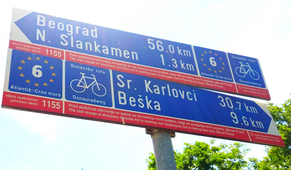
I hadn't noticed it before, but every EuroVelo sign in Serbia (and the route is very well sign-posted) has an aphorism – every one different. This one (above) quotes Proust, and is quite apposite. Further on I spotted one that left me more puzzled. It said, “What is the purpose of the giant sequoia tree? The purpose of the giant sequoia tree is to provide shade for the tiny titmouse” - Edward Abbey. I had to Google the late Edward Abbey. I found him described on Wikipedia as “America's prickliest and most outspoken environmentalist.
Pulling up on the road by the turning to my campsite, I got chatting to two Dutch cycle tourists on a tandem whom I'd been tailing for several kilometres (saves map reading). Turns out they too are heading for Istanbul, though our routes will part as they are going down so-called “Sultans' Trail”, via Sofia, rather than through North Macedonia. I've got to the point where it's no longer unusual to find cyclists headed for Istanbul. I left them to head for the luxury apartment they'd rented in Belgrade for the weekend and went to buy a cucumber.
Day 44, Zemun, Belgrade to Kovin (84 kms)


Crossing the Sava River Bridge into Belgrade
Little shade and very high temperature made it a hard day's ride, mainly along unsurfaced flood dykes. I took extra water and food in the expectation that I might have to stop and wild camp if the heat got too much. At the (very nice) industrial town of Pancevo on the River Tamis a local man asked me what it was like cycling in such heat. He said he'd just returned from Paris, where it was 19 degrees. “Then I get home, and it's like Africa”, he said. I said it was OK, as long as you kept moving -- which cools you down.
The initial 15 kilometres into Belgrade from my campsite covered territory I saw from the windows of a bus on Day 43, which I took as a day off to visit the city. It was a visit that made me think more than once of that Proust quote about travel helping one to see things differently – perhaps as others see them. I began by visiting the old fortress on a hill overlooking the confluence where the Sava River flows into the Danube. The site – which actually now holds the only pre-18th century buildings surviving in Belgrade – has been fortified since the third century BC and has a lengthy (and obviously bloody) history which I'll not go into here. The site is now is managed by the city authorities as Kalemegdan Park. There was a festival of youth dance and music when I was there – a bit like a Welsh eisteddfod – as well as three photographic exhibitions. One exhibition was about the history of bathing in the Sava River (good for rheumatism, neurasthenia and neuralgia) and hailing “a brave young lady called Femka”, who in 1887, reportedly clad in a red swimsuit, broke with tradition and swam with the men! There was also an environmental exhibition; another, in the underground gunpowder store, was about “women in the early days of socialist Yugoslavia”, featuring lots of photos of Tito and different women. But the main outdoor exhibition was about Gabriel Princip, the 19-year-old Bosnian Serb student who assassinated Archduke Franz Ferdinand, heir to the throne of Austria-Hungary, and his wife, in Sarajevo in June 1914. The shootings set off a chain reaction that led within weeks to the First World War, The exhibition covered Princip's life, education, the events themselves, and his death in jail four years later, with many rare photographs, including from within the court room, and even one of his parents, taken in 1918, after their son's death and the end of the war. In Britain, I think, we see Princip merely through the lens of what happened -- the Somme, Ypres, and so much other senseless slaughter. In Serbia, he is seen as a Serbian and Yugoslav national hero, for getting rid of a man regarded as a tyrant. This was the first of two eye-openers.
The second came when I visited the “Temple of St Sava” in the city, one of the largest Eastern Orthodox churches in the world. Designed to match the Hagia Sophia in Istanbul, it was begun in 1935, halted when it was the height of a large house in 1941, used as a war store, and recommenced in 1985 after 100,000 people attended a liturgy at the site, forcing the then Communist government to lift a ban and re-issue planning permission.
Coming from a Protestant background, I found it a bit of shock. The first thing that greets you as you go in are two large souvenir/icon shops. Then, there are no pews to kneel at. As I was standing there a bit discombobulated, Orthodox Christians came in and kissed icons (pictures of Jesus and various saints) which are placed about on lecterns.
The other shock is the interior -- dazzling without restraint. According to what I have read, the Orthodox Church believes God should be glorified with a display of magnificence. In 2011, Russian president Vladimir Putin visited St Sava's, which then had bare interior walls and ceilings, and promised support. A plaque notes that the Russian state oil and gas company, Gazprom, has since “invested 10 million Euros” to cover the main dome, sanctuary and the main part of the ceiling with gilt and mosaics, a project that took more than 70 master craftsmen more than six years to complete.
It's funny how you bump into the same people, by the way. Belgrade has a population of 1.23 million people, yet after a goulash lunch, as I was on my way from the old fortress to the new cathedral, who should I see but the two Dutch tandem-riders. They told me they had decided that as they did not expect to camp any more, but would be staying under various roofs on the rest of their trip to Istanbul, they would pack up their camping gear, take it to to the Post Office, and send it back to Holland. The exercise had taken much of the morning, they said. The counter clerk hadn't spoken English, so they'd used Google Translate to itemise what was in their parcel. The app had translated “camp cooker” as “camp cocaine”. As can be imagined, this had done nothing to speed things up.
My day off in Belgrade concluded with a quite unnecessary trip on a tram. It would have been quicker and more direct to take a bus, but I like trams, particularly old and rickety ones. This was a Czech-made Tatra KT14, I suspect one of the last KT14s made, one of a batch produced specially for Belgrade in 1997.
Cycling through the next day took me past the former Seven Poplars Beach. It's a bathing spot no more (swimming in Belgrade has shifted to an island in the Sava called Ada Cinganlija.) Where the young lady called Femka swam with the men are now moored rows of floating restaurants, bars and nightclubs, known in Belgrade as splavovi. In the late 80s, when Yugoslavia began to permit a degree of Western-style private enterprise, it emerged there were plenty of entrepreneurs but a shortage of commercial property. The answer was the splavovi, or splavs for short, which give the city a totally unique night-time ambience.
So as not to cover ground I'd covered on foot, I took a shortcut through the docks and a decaying heavy industrial area. On a supposedly closed-off Danube wharf, in front of a row of huge abandoned silos, an enterprising young woman had set up rows of deck chairs and a make-shift counter and was selling soft drinks, coffee and ice cream at highly competitive prices. I was just getting over the surprise of this (not least how a large team of security guards were completely ignoring it) when I realised that two of the silos, which I'd estimate to be 80 to 100 feet high, had been turned into climbing walls by some other young entrepreneurs. Later, I met a Serb-American, who divides his time between the town of Kovin, and New York. He says Serbia is a great place to live, and very cheap – property tax is about 200 US dollars a year. But he says you need to be careful who your neighbours are. Tourists are unaffected, but you cannot live here without coming into contact with a gangster underworld. He has invested heavily in security devices, and spends some of his time in Serbia staying not in his home village, but elsewhere, in hotels.


Pop-up "beach cafe" and climbing walls in old industrial site
Day 45, Kovin to Beli Bagrem (55 kms)


Arriving on the ferry below ancient Ram Castle, after a ferry ride that would have been worth it for the views alone
More than 40 kilometres of today's ride has been on unsurfaced tracks along the floodbanks of the Danube and the DTD (Danube-Tisa-Danube) canal. It's been like bumping along over a badly rolled lawn, with occasional deeply rutted sections where cars have been driven when it was wet, only for it to dry out in the sun hard as brick. But the slow going has given me an opportunity to appreciate what an extraordinary variety of wildlife lives along the Danube corridor.
Cycling downstream along the dykes with the river on one's right is like travelling through two different countrysides. On the river side, the concrete-sided dyke holds back the wetland, a place of vibrant, vivid greens. Trees with their roots in the water, grasses and reeds make up a habitat rich with birds and animals. Known as “floodplain forests”, the wetlands feature poplars, elms and maples, and constitute a major carbon sink to buffer against climate change. Pedalling along I saw otters, beavers, storks – including a rare black stork – cormorants and many herons. The cuckoo was frequently heard, and, as always, the golden oriole. To the other side is parched grassland, with goatherds, cowherds and shepherds watching their stock grazing what they can find.


Parched v. verdant: Contrasts in vegetation either side of the flood dyke
After 25 kms of bumping along, the Ven. Claude and I reach some tarmac and glide happily into the little village of Dubovac for lunch on a park bench, before continuing to Stara Palanka where we need to get a ferry to Ram, across the Danube, where the EV6 avoids a section of Romania which is not considered the best option at this point. Unfortunately, I hadn't realised the ferry was only three-hourly, and thanks to the park bench lunch we've just missed one and the next one's not for ages. I settle down for a Greek coffee and aerated water in a cafe by one of the two ferry “ramps” at Stara Palanka – a slope of sand and gravel which has to be smoothed out by two ferrymen armed with shovels every time the thing arrives or leaves. The actual trip out of the DTD canal and across the Danube proves to be the best ferry ride yet: Pushed along on our floating platform by another ancient boat, we can see right down the great river in the direction of the Iron Gates Gorge. For a while I think we're going to get into a game of “who's chicken?” with a big motor freighter steaming upriver. Strictly speaking, if I remember the rules of navigation correctly, other traffic is supposed to give way to ferries, but this freighter doesn't look as if it has any intention of altering course – maybe it can't – so wisely the ferry skipper eventually heaves to, and we let it pass. The trip across the river takes more than 25 minutes and is like a mini-cruise for £4 (if you don't mind taking your cruising standing up). We land under the majestic ruins of Ottoman-era Ram Castle.
On the ferry I meet Jean-Marie and Guy, two retired chaps only slightly younger than me, from Brittany. They are cycling from Brest to the Black Sea, in aid of a charity that fights childhood cancers. We'd seen each other but not spoken when we were at the same campsite at Belgrade. We then end up at the same campsite again, this one beside the stunning Srebrno jezero (Silver Lake) near Veliko Gradiste. This is an oxbow lake, created, as I recall my old geography master hammering into me for O Level, by a natural process from a meander. The Srebrno jezero is separated from the Danube by massive banks of sand, which filter the river water, making it perfectly clean and suitable for swimming. A little strand of shops and restaurants has grown up beside it, and JM, Guy and I decide to go out for supper. A large beer, salad, and a plate of goulash and mash sets us back the equivalent of 10 Euros each. JM and Guy reckon they'll be at the Black Sea in a fortnight from now. I have further to go, and two major mountain ranges on my planned route to Istanbul through North Macedonia and Greece, and as yet I can't confidently say when the Ven Claud will reach the Asian bank of the Bosphorous.
Day 46, Beli Bagrem to Donji Milanovac (77 kms)


Golubac Castle, which rises right out of the waters of artificially-created Derdap Lake on the Danube, at the start of the Iron Gates Gorge section. The cycle route follows a corniche road, including 18 tunnels, the first of which can been seen (right)
An (almost) all-tarmac day: A pleasant 20 kms into Golubac, a puzzling 200 metres through some brambles which I'd never have found if a woman hadn't come along and beckoned me to push Claud after her; and then 57 kms along a corniche road that winds along the side of the cliffs that rise at points 500 metres above the Danube. The great river was dammed in 1972 to create one of the largest hydro-electric power stations in the world, and to tame it for shipping. Much was drowned or partly-drowned in the process, and the first thing one passes that was so affected is the magnificent Golubac Castle (Golubacki Grad), dating from 1335, that now appears to rise straight from the water, its lowest parts having been covered.
The EV6 is on the main road for the whole of the way from Golubac to the new town (old one drowned) of Donji Milanovac. Fortunately, it is not a very busy main road, for it passes through no less than 18 tunnels. None are over 300 metres long, however, and I was spooked only by the first one with a bend in the middle – which made me realise I really should have my front light on as well as my rear – and by the sheer noise a lorry makes when it's behind you in a tunnel, even when it's behaving itself perfect properly. Funnily enough, I'd had a discussion over supper the previous evening with Jean-Marie from Rennes, about Serbian drivers. He agreed with me that lorry drivers in Serbia give an impressively wide berth to cyclists, so one rarely feels unsafe, but he contended that Serbian car driving is “aggressive” (I don't agree, but they can certainly be fast). He postulates that the difference is because Serbian lorry drivers have to visit France as part of their job, and pick up good manners when they are there. Serbian car drivers don't so often visit France so are not in that way brought up to scratch. I pass that on for what it's worth.
Further on, the EV6 passes Lepenski Vir, where in 1965, archaeologists surveying the area that would be flooded found an area of seven human settlement phases, 136 sacral and residential buildings, some of dating back more than 8000 years, and the oldest monumental stone sculptures yet found in Europe (an art historian at the University of Belgrade said they looked like Henry Moores). Because the dwellings and other buildings showed signs of having been planned, terraced and spread in a fan-shape, allowing access to the river by people from houses further from the bank, were within an organised society, and even included a necropolis, some scholars have called Lepenski Vir “the oldest city in Europe”. To prevent this extraordinary site from being lost when the waters rose, much of it was relocated 30 metres up the bank in 1971. Protected by a vast glass roof, it now constitutes the Museum of Lepenski Vir. Really surprisingly, when I visited, I was the only person there.
Day 47, Donji Milanovac to Trajan's Bridge, Kostol (75 kms)
The morning's ride saw His Venerability and I continue along the thankfully-quiet main road alongside the Iron Gates Gorges, where the Danube forces its way through the Carpathian and Balkan Mountains between Serbia and Romania.
The route took us up to a summit at 276 metres, with spectacular views, and three or four more unlit tunnels. The longest one, nearly 500 metres, was equipped with a button to press to warn approaching motorists that cyclists are in the tunnel. This would be a very good idea, if the buttons worked.


A pause for a view of the Iron Gates Gorges
Now, I've been warned about the problems cyclists have with dogs in the Balkans – chasing, barking, possibly biting, have all been mentioned, with Bulgaria named as the worst for this. Well, I've had a problem with dogs in Serbia – they break my heart. Twice when I stopped in laybys to look down the Danube scenery I found stray dogs living there, just by the side of the main road. One was sleeping under a picnic table, where someone had left out a tin of water for him. Another, a young labrador-cross of some kind with a beautiful face, was living in a cardboard box. I saw it adeptly crossing the road, dodging between a van and a heavy lorry, but you can only get away with that sort of thing for so long before the string runs out. I hope someone who lives here finds it and gives it a home. I have to recognise there's nothing I can do for these dogs – in fact to show kindness would merely invite them to follow me and put them at more risk. Further on at the side of the road I saw the body of a dog for which the risk, in the end, had been too great.
Reaching the end of the gorges at Derdap Dam, I decided that I would definitively ditch any notion of including Romania in my trip – it would have been easy enough to go through border control and re-enter the EU for 24 hours by taking the road over the dam, but the 15 kilometres from the dam to Drobeta-Turnu-Severin are notoriously miserable for cyclists because of the volume of heavy lorries, and one glance across the river to the road on the other side was confirmation enough.
Continuing on the Serbian side meant I parted ways with fellow cyclist Peter from Germany, who I'd been overtaking, and being overtaken by, repeatedly since Belgrade (I even found him behind me at the checkout when I went to the shop to buy supper at Donji Milanovac – quiet funny!) as Peter is continuing along the EV6 through Romania to the Danube delta, while I am following the EV 13 south. It also meant I parted company with Mike Wells' excellent guidebook to the EV6, in favour of the Bikeline Guide to the EV13, written by a recently-retired German MEP, Michael Cramer.
Determined not to repeat a problem I had the day before, where not taking opportunities when they presented themselves led to me lunching on a tomato and a packet of crisps, I stopped soon after the parting of ways for a late lunch at what looked like a popular working man's cafe. I'd guessed right that it would be good, and was rewarded with an excellent pork chop with chips and salad for £6. The waitress at this cafe was a memorable woman: very tall, with bright red hair, she communicated entirely by means of shouts. She stood in the doorway and shouted to people at the tables outside to find out what they wanted, and then turned round and shouted the results to the kitchen. She held good-humoured shouted conversations with numerous people all at once – a man delivering soft drinks, her boss inside, and random passers-by on the pavement. But shouting at me was clearly not going to work, as she plainly realised I wouldn't have the faintest idea what she was saying. I was just looking at my phone, waiting for her to take my order in a different way, when she came over and poked me, robustly, on the arm, then by gestures worked out what I wanted. Later, she came back, poked me hard again, and presented the bill. I pretty sure that, as a general rule in the hospitality industry, poking is frowned upon as an activity like to cause affront, especially among people who are prone to being affronted, but, from her, I wouldn't have expected anything else. We parted smiling.
I stopped for the night at Kostol, Serbia, just across the Danube from Drobeta-Turnu-Severin in Romania, after visiting the remains of a remarkable early achievement in engineering -- Trajan's Bridge. In fact, the lovely £11-a-night guesthouse where I slept in a bed rather than on a roll-up mat and the the Ven. Claud tested beneath a trellis of grapes, is named after the Roman bridge.


The remains of one of the piers of Trajan's Bridge, completed in 105 AD. More than a kilometre long, it was used for 165 years, having been commissioned by the Emperor Trajan to assist in logistics necessary for the defeat of the Dacia tribes, whose lands around the Danube were studded with gold mines that the Romans were keen to get their hands on. It held the record for being the longest bridge in the world for over a thousand years -- and is celebrated in one of the reliefs on Trajan's Column in Rome.
Day 48, Trajan's Bridge to Negotin (60 kms)


A stop at a shady spot near the village of Kusjak
My kind landlady at the Trajan's Bridge guesthouse made me a Turkish coffee and gave me a bag of fresh apples from her garden – in mid June! – to fortify me for my journey to Negotin. In Negotin, I am spending two nights, to rest, use a washing machine for the first time since I started, and to plan the remainder of my journey. The venue for all this is the wonderfully-named cyclists' guesthouse "Base Camp For Adventurers Urban Guerilla". I booked a glamping tent for my stay but when I arrived the host, Bojan, a legend among long-distance cyclists, insisted I take a garden room for the same price. It is the most comfortable “camping” I have ever done: A whole wall of my temporary abode is lined with books in Serbian, including six volumes of Hemingway, seven by Erich Marie Remarque (and I thought All Quiet On The Western Front was his only one), both volumes of Anna Karenina, and numerous others I can't identify at all because they're in Cyrillic script. There are also loads of books on cycling here, some, fortunately, in English. Bojan, a long-distance cyclist himself, is very kindly going to show me some routes on the map, and give me some very welcome local advice and knowledge before I leave. I'm also going to give the Ven. Claud a once-over and try and buy a new handlebar phone holder as my guaranteed top quality one by Whale Fall, fell (apart) – after only 3130 kms. Hope you read this, Whale Fall.
The route here involved doubling back slightly from Trajan's Bridge to by cross a small ridge above the town of Kladovo on a quiet main road, before dropping down to a good quality and delightfully shady track right by the Danube, which I followed for some 40 kms. The only thing of any moment that I can think of is that when leaving Kladovo I noticed what was obviously a school bag lying in the middle of said main road, with trucks and cars swerving round it. As I was wearing my very uncool forklift-truck driver's high-vis vest (the item that, more than anything, marks me out as not a serious cyclist) I was able to nip into the road and wheech the bag out of the way before it got run over. Kladovo is a town of almost 9000 people, but the first person I found knew who it belonged to and undertook to arrange its return to the child's parent. Since it contained a packet of fags as well as a purse, pen, folders and jotters, I imagine a row ensued.

"Camping"
Day 52 Knjazevac to Pirot (67 kms)


Beside the road to Pirot, looking up the valley
After a stay in an unlikely-looking “guesthouse”-- the former front office of a motor garage – the kind owner, a mechanic, presented me with a cucumber before I set off. I wonder how he knew I liked them? He also showed me several pictures of his cucumber and tomato plants on his mobile phone. I don't have pictures of my vegetable plants on my phone, just my family and dog. But he was a very nice man, and I believe we got on well, even though he had no English at all and we couldn't understand a word each other was saying.
Today's ride was as pleasant as yesterday's wasn't – scenic, undulating and smooth up a quiet main road through a valley by the Trgoviski Timok river, gaining overall about 400ft. I stopped for lunch a waterfall, and was greeted on the way into one village, Kalna, by a veritable posse of village dogs – may be 10 to 15 of them, running down the road straight towards me, barking, but just having fun.
One thing quite startling for someone of my age, who worked on farms as a teenager, is that the workhorse on very many Serbian farms is still the “little red tractor” of more than half a century ago in the UK – the old Massey Ferguson. From 1954, the year of my birth, onwards, some 4000 Massey Ferguson diesels were produced under licence every year by Belgrade based Industrija Mašina i Traktora and sold branded as IMT 533s. Many thousands of them are still in daily use. It's quite something, cycling through the countryside and hearing the familiar sound of a Perkins 3-cylinder engine and that old exhaust note, still as perfectly-pitched as an organ pipe.


An IMT 533 catches up with the Venerable Claud on a hill out of the village of Strbac
The landlady of the guesthouse I'm staying in tonight (who has a copy of Das Kapital on her bookself) spent an absolute age examining my passport before allowing me up to my room to have a shower, pouring over the stamps in it, mistaking “Londres” (French border control, St Pancras) for “Los Angeles”, and repeatedly asking me via Google translate, “From where and at which border crossing did you enter Serbia?”
Tomorrow, I should be back in the EU -- in Bulgaria. It'll be a short day, as I shall be waiting for a while in Dimitrovgrad for another long-distance cyclist headed for Istanbul (who I haven't actually met, by the way), with the idea that we might cycle on together. I think they will turn out to be much younger and faster than the Venerable Claud and me, and I suspect they'll soon get fed up and go on themselves.
Days 50, Negotin to Grilste (86 kms) and 51 Grilste to Knjazevac (36 kms)
My day off in Negotin gave me an opportunity to re-charge, and do some planning. Base Camp Urban Guerrilla was perfect – Bojan and his family were so welcoming and supportive it felt almost like being at home, and unlike my other days off, I wasn't sightseeing so I could just relax. I replaced the phone holder, went for a haircut (the barber said he'd make me “less air resistant”), and then had an odd experience while trying to order lunch: I sat down outside a cafe, asked the waiter if I could eat, and he said “No”. I left, and I'd just got round the corner when who should come running after me than another cyclist, Marvin, whom I'd met way back in Passau and had last seen, briefly, in Vienna. He'd been sitting outside the cafe (I'm terrible at noticing people), had heard the exchange with the waiter, and he told me that exactly the same thing had happened to him. Somehow he'd worked out that what you had to do was to go and speak to a woman inside. I did so, and this immediately produced a huge plateful of delicious stuffed peppers. Neither Marvin nor I could work out what the thing was with the waiter.
I'm now getting to the point where my route will no longer be signposted, where I will be departing significantly from the EV6/EV13, and where the going will be tougher, so I was grateful when Bojan offered to sit down and go through my options for the next couple of days. He gave me an additional map, and I also spent a couple of hours forward planning. It looks as if I could shave quite a bit of time off the journey if I cut east after visiting the monastery in the Rila Mountains – leaving out North Macedonia, the Rhodope Mountains, and some of Greece. I'm going to see how I get on in the first lot of mountains.
On the morning of Day 50, Bojan produced a Greek coffee and a delicious pastry for breakfast. I said goodbye to Marvin and two other Germans, Thomas and Gabby, who were also there, and who very kindly refrained from mentioning Scotland's performance in the Euros the previous night. When I asked the best way to get on the right road out of town, Bojan insisted on cycling with me to the city limits. Talk about going the extra mile for his guests! His daughter took a photo of us setting off.
The route Bojan showed me varied from the EV13 and definitely saved time, utilising an old road that runs parallel to the new main road to the next main town, Zajecar, from where my route rose steadily to a summit of 471 metres before plunging back down almost as much to remote Grlisko Jezero, in the foothills of the Tupiznica massif. This was where Bojan had suggested I camp, so I checked with some people who were fishing that this would be OK – they seemed pleased to be asked – and settled down for the night. No phone signal, no shower of course, and I can't even wash in the lake because that might scare the fish. But I've no official engagements tomorrow so who cares?


Early morning at my camp beside Grlisko Jezero ("jezero" means "loch")
On my way to the lake I'd been flagged down by a farm worker. He checked if I had enough water and asked me where I was from. When I said I'd come from Scotland he said “Germany! 5-1!" and slapped my palm with heartfelt condolences. The international language of football. Shame I don't speak it particularly fluently.
I've been advised to carry a stick from now on because dog attacks on cyclists are supposed to be a hazard. The idea is that if threatened, you raise the stick in a menacing manner, and the dog backs off. You don't hit the dog. The gesture should be enough. I'm sure I'll be entirely unconvincing.
I've been run at by barking dogs about a dozen times today – the first day it's really been a problem. So far I've either managed to pedal off quickly so they give up, or tell them not to be ridiculous. I think it's more Claud's wheels they are after than my legs, though that's not the consensus among other cyclists. Coming along the bumpy lane to my camping spot, I was harried by a hairy mutt, who, to be fair, seemed more interested in sniffing me than biting me. I was surprised when one of the fishermen saw it, pulled out a pistol, and without further ado fired a volley of blanks into the air. The dog vanished quickly. This is one of the ways life here is quite different from Scotland.
When dusk fell, the hedgerows around were lit by by fireflies. It's interesting, though, how much colder it is at night here – cold air slipping down the mountains to the lake.
At 6.00 am the next day – Day 51 – I was woken by something sniffing round my tent. It was the dog. Mist, like smoke, was rising from the lake under the first rays of the sun. I wanted to cook my porridge, on my camp stove, at nose level to the dog, and I didn't want to shout at it, because the fisher-folk were still asleep, so I thought I'd practise being menacing. I lifted the stick and looked at the dog sternly. It sat down, wagged its tail, and looked back expectantly. I put down the stick. It picked up the stick, dropped it at my feet, and looked at me expectantly again. I knew I'd be unconvincing.
I had magnificent views of the Tupiznica during much of today's ride, which included a 10 kilometre uphill off-road section on just about every adverse surface you could think of – soft sand, scree, rocks the size of half-bricks, mud, long extremely heavily-rutted sections, sections overgrown by trees and thorny briars, and, to add further interest, wild boar hiding in the undergrowth and crashing off with unearthly screams. Great mountain-biking terrain. Not so good for a heavily-loaded classic tourer and we made extremely slow progress. I had hoped to get much further, but had to retire exhausted having achieved only 36 kms all day.
Day 53 Pirot to Dragoman (Bulgaria) (52 kms)
A quick 25 kms down the old road that runs parallel to the motorway got me to the border town of Dimitrovgrad for elevenses. On the way in, I noticed a retired Bosnian-built steamroller on display. I checked the maker's plate and found it was built in 1954, so 70 this year, same as me (not retired).
Just as I was rolling down the main street myself, who should I see about to roll out on their tandem but Frits and Carla from The Netherlands – who I last saw in Belgrade. Extraordinary how we keep bumping into each other, especially as we took quite different routes through Serbia.
I had a burger and a coffee, then Juli from Germany turned up, offered me an ice cream, and we discussed a broad strategy for the next few days. She'd already done quite a few kms so she decided to stay the night in Dimitrovgrad, while I carried on a bit – she will catch up tomorrow.
There were no major delays at border control between Serbia and Bulgaria, though literally miles of queuing, horn-honking lorries coming the other way. Bulgaria has just become part of the EU's “Schengen” borderless travel zone, and, ironically, Serbia has had to tighten up in response.
The next bit of my route involved quite a climb – from about 400 metres to over 900 metres on a tiny back road, and back down to 700-ish again, in order to avoid cycling on the motorway below (where I could still see and hear the lorry-queues hundreds of feet below). I didn't make things any easier by convincing myself that a track going off to the left was the way down, and had descended about three-quarters of a kilometre, past a community of angry dogs, before realising my stupidity and having to cycle past them again, this time more slowly, which absolutely enraged them. Then, when nearly at the summit, I was pulled over by a border patrol who checked my passport a second time, giving the stamps almost as much scrutiny as my landlady in Pirot. They let me carry on after a short while, but seemed to be under the impression I was French. (Apparently it is quite common for cyclists and hikers to be stopped and questioned in border areas of Bulgaria, so it is important always to have one's papers with one, even when going for a walk.)
Bulgaria is an hour ahead of Serbia (BST+2), so what with the climb, the ice-cream, the border, getting lost, my general slowness, and a couple of kilometres on cobbles to cap it all, it was quite late by the time I pulled into the rather one-horse town of Dragoman, where somewhat incongruously, there is a very nice, modern hotel. With no other options, and not wanting to wild camp with the border patrols around, I booked in. It was still less than a Travelodge in Tewkesbury, but posh for this trip. I asked the chap at reception where I could put the Venerable Claud. “In the conference room,” he replied. Of course. When I opened the door, Frits and Carla's orange tandem was already there.


Incongruous: The Dragoman Hotel
Day 54 Dragoman to Sofia (53 kms)


Countryside above Dragoman
German cyclist Juli, who must have set off at crack of dawn from Dimitrovgrad, caught up with me after I'd been on the road for about half an hour. Incidentally, it turned out that neither she nor Carla and Frits – who'd actually suggested it – rode the mountain route to Dragoman: they all just decided the motorway wasn't very busy and rode down the side of it. I would suggest that anyone doing this route in future follows their example. I was the mug who cycled up and down something almost the size of a Munro to cover very few linear kms.
About 28 kms from Sofia, we found that the route I'd planned on CycleTravel was blocked by road building, so we diverted onto one from Komoot, but it turned out Komoot must have been having a bad day as well as we ended up having to a) cycle down a motorway busy with lorries; b) push our bikes up a sheep-track and c) cross a rusty footbridge with missing sections of steel plate. It wouldn't have killed us if it had failed, but we'd have got very wet. The Venerable Claud went first on the basis that if the bridge could take all that weight, it would be fine. It took more than two hours longer than it ought have done to get to Sofia, so after a quick Coke in the city centre I headed to my abode – the excellent Green Cube Capsule Hostel, which turned out to be much less like those Spanish vertical graveyards than most capsule hostels. Then I sat down to plan my forthcoming day off in Sofia. Strange to think this will be my last big city before Istanbul, and unless I decide to cycle through Greece for a few kilometres (an option, not a necessity) I could already be in my penultimate country. Although Bulgaria is in the EU, it feels much more “foreign” than the nine others I've passed through already. Bulgarians really do shake their heads for “yes” and nod for “no”, and because one's own instant facial response to this is usually the wrong one, confusion spirals. More confusingly still, Bulgarians know they are the exception rather than the rule in the nodding and shaking business, and will sometimes adapt their behaviour when talking to a foreigner. But of course you don't know whether they are, or they are not. I got in a right mess while trying to make a debit card payment. I and the chap behind the counter went round and round in circles before I presented the card with a flourish and a smile like Alan Freeman advertising Omo and the message got through. A smile is universal. In order to avoid further faux pas, I have consulted “Bulgarian customs and etiquette” (see welcometobulgaria.bg) and I now know that it is very rude to put anything on the floor (floors are considered dirty); that flowers must always be sent in odd numbers except in cases of mourning; and that it is rude to be loud. Some members of my family might wish to note that one. And I have noticed that trams sometimes stop in the middle of a four-lane highways and open all their doors to let passengers dodge on and off through the traffic.
Day 56 Sofia to Samokov (68 kms)


Still patches of snow visible in the north-facing corries above Samokav -- despite the scorching heat
I was well caloried-up for today's ride, having capped an interesting time in Sofia the day before with a lovely meal at a local restaurant with the tandem-riders Frits and Carla – a doctor and a public health economist (if I've understood that correctly) from The Netherlands – and political masters student Juli, from Munich. It was nice for all of us, after a long time on the road, to get round a table for an evening of good food, good conversation, and really good company.
Earlier I visited “The Red Flat”, a preserved home from the Communist era, and learned several things I didn't know – such as that you were allowed to own property, just so long as it wasn't too big, and that tourism in Bulgaria was launched after the war as a way of paying back the Czechoslovakian government for Bulgaria having peremptorily nationalised Czechoslovakian-owned heavy industry without compensation-- the deal was that in return for the Czechs not cutting up rough, the Czechoslovakian people would get free holidays on the Black Sea Coast.
In the flat, I also had a look at a “Balkan Bike” – millions of these were made between the end of the way and the fall of Communism; They were designed to be so adjustable that the whole family could share the same one – children, women and men. The entire bike was made in Bulgaria (apart from the rear hub, which was made in Russia).


A "Balkan Bike". Millions were produced from the 1960s to the end of the Communist era
I also visited, and can recommend, the Archaeological Museum, and a look at St George's Rotunda Church with its adjacent Roman remains. Built in the early 4th century as baths, the Rotunda was converted into a church on the orders of the Emperor Constantine who said, following his conversion to Christianity, "Serdica [now Sofia] -- that is my Rome".

Cyclists round the table: Me, Juli, Frits and Carla
Today's ride was a steady climb from Sofia between the Rila, Vitosha and Sredna Gora mountain ranges to Samokov, up the valley of the Iska River, which runs from the Rila Mountains to the Danube.
The “Cycle Travel” planner did a good job of getting us out of the city while avoiding the worst of the traffic, and it was not long until The Ven. Claud and I were passing a huge reservoir on the river, which, since it was officially opened in 1954, has satisfied two-thirds of the water requirements of Sofia. When it was originally planned, back in 1901, it was to be called St Peter's Reservoir, then after the Second World War that was changed to “Giant-Reservoir Stalin”, and now it is simply the Iska Reservoir.
The road was a lot busier than I'd expected, maybe because it was a Friday and people were escaping to the hills. There was lots of cheerful tooting and even some clapping and cheering as we pedalled on. Not sure I like the attention! I was pleased to pull over for lunch in the cool of some pines.
It is clear that the high temperatures now affecting the Balkans are going to be an element this week – to be tackled by early starts and using accommodation with air con rather than my hot little tent, I think -- but despite the mercury hovering at 35 degrees as we pulled into Samokov there was still visible snow in the north-facing corries in the mountains above the town and the nearby ski resort of Borovets.
I was also struck by the sheer size of this storks' nest on a telegraph pole as I approached the town:


Stork, with two baby storks, not visible from this angle, on a nest that must be 12 ft tall
Day 57 Samokov to Pazardzhik (100 kms)

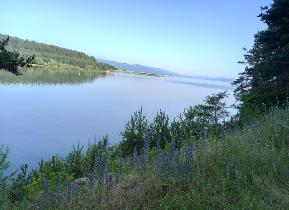
Morning above the Iska Reservoir
The first 65 kilometres (rough estimate) of today's route were matchless – the most enjoyable ride of the entire trip, full stop.
We set off at 7.30 in the blessed cool of the morning. I say “we” -- I'm now riding with Juli, and we'll probably keep that up as we both head towards our shared destination, Istanbul. It's quite lonely on the road now. One rarely sees another cyclist, let alone another long-distance cycle-tourist.
So I shared my location on WhatsApp, and we met in the centre of Samokov, heading out, initially, round the south-eastern end of the Iska Reservoir before gaining some height along quiet roads, through villages, and past flower-filled meadows and contouring a few hundred feet below a ridge in the foothills of the Balkan Mountains. We then began a spectacular descent for many kilometres down a serpentine road past the well-preserved “Trajan's Gate” Roman fortress (also known as Stenos Fortress) where in 986 the Bulgarians defeated the Byzantine army. I should have stopped to take photos, but I was having far too much fun. All good tarmac comes to an end in eastern Europe, however, and the route eventually deteriorated to gravel and then a stony track, brambles to the left of us, nettles to the right, before ending in 12 kms of straight, boring, not particularly busy, but fast, highway. Traffic is no heavier here than in Serbia, but while the Serbs struck me as quiet, sober drivers, the Bulgarians drive far quicker, and obviously have far more money to splash out on fancy cars to show off in. The roads are full of shiny Mercedes 4x4s, new Audis, Teslas and even a Rolls. We passed through arable fields into Pazardzhik. The town was Bulgaria's rice-growing centre, and known as the capital of “the Egypt of Europe”. Exposed to world markets after the fall of the Iron Curtain, demand for Bulgarian rice fell off a cliff and hardly a grain is now grown. Wheat, barley, oats, tomatoes, peppers, cherries and wine are the staples now on the Upper Thracian Plain.
I left Juli to go to her accommodation in town and pedalled on to mine, out on what might be called the town's "motor mile”. I am staying in a very cheap and bizarre hotel next to a petrol station. Part of the hotel is used as a car parts showroom. It has mock-Regency curtains and chaise-longues on its landings, and a sweeping staircase leading down to a grand reception foyer with more reproduction furniture and a rack of dusty batteries.
As luck would have it, just across the road, in equally unlikely premises, is the Hygge Restaurant – Bulgarian food, not Danish, goodness knowns why "Hygge" – where I had a delicious and inexpensive plate of pork, potatoes and capers.
Day 58 Pazardzhik to Plovdiv (45 kms)


Neatly-painted houses in Old Plovdiv
Leaving Pazardzhik at 6.50 am, we were at Plovdiv city limits before nine after an entirely flat, pleasant ride in the cool of the morning, with the Rila mountains blue-ridged above the plain. At one point our route ended abruptly at a railway line – I do mean a railway line, not a level crossing. After locals gestured to us what the correct procedure was, we carried our bikes up the embankment, across three sets of tracks and a ditch, and down the other side, where the road continued.
Plovdiv, the second city of Bulgaria, turns out to be just gorgeous. Our route took us in past the purpose-built 2.2 metre-long rowing canal, venue for the European Rowing Championships a few years ago, the largest facility of its kind in the Balkans. It has also become a cycling, jogging, and general sports hub and has a friendly, athletic buzz. I felt a pang for my youth as I watched fours and, in particular, single and double skulls being put through their paces by coaches on bikes on the banks.
The route then took us along the banks of the Maritsa river, through an underpass with Roman remains jutting out of the walls, and up into the Old Town. Not for nothing is Plovdiv, founded as Philippopolis in 342 BC by Philip the Great (Alexander the Great's father), known as the City of the Seven Hills. (But unlike Rome, it is now a city of six hills, because the seventh was quarried away for roadstone).
After passing the remains of the Roman stadium (built under Hadrian in the 2nd century AD) we stopped for a coffee and baklava before parting to do our own things – in my case to surprise the landlady of my accommodation by arriving at 10.30 on a Sunday morning. (It did say check-in from 10 am, but the previous guest was still asleep in what was to be my room so, after locking the Venerable Claud to the common stair and leaving my luggage, I went off the explore.)
The arty, cosmopolitan city has a beautiful well-cared for Old Town, the remains of both a Roman odeon and an incredible 7000-seat Roman theatre, still in regular use today. In fact, together with Juli and John, a young American backpacking round eastern Europe who was staying in her hostel, I attended a free evening concert at the theatre for a while -- the degree show of the city's Conservatoire. It was an extraordinary feeling, sitting where Romans would have sat to watch classical tragedies and comedies 2000 years ago.


The interior of the Sultan Murad Mosque, Plovdiv, built in 1358
I'd like to go back to Plovdiv sometime, maybe for one of its arts festivals. Here's one more thing I learned about this sweet-natured town, just as I was leaving: The lamp-standards in the streets round the town's hospital are linked to a special circuit board in the maternity department. Whenever a baby is safely delivered, a nurse on duty presses a button, and the street lights flash on an off in the rhythm of a newborn's heartbeat. And everyone in the streets claps and cheers the new life.
Day 59 Plovdiv to Haskovo (115 kms)
Setting off early from a shady square by Plovdiv's beautiful mosque, a symbol of the town's religious tolerance, began a long and speedy ride to Dimitrovgrad (the Bulgarian one), past sand martins nesting in a sandstone bluff, acres of sunflowers turning their heads to the rays, and fields of wheat and barley where the cereal harvest is already well underway – the combine harvesters won't be out at home in Scotland for a couple of months yet.
Arriving in Dimitrovgrad by lunchtime, Juli from Germany and I sat down in a cafe for a cold drink, smug at a task accomplished. I then discovered on the website of the campsite I was heading for – one of the very few in Bulgaria and described as an “oasis” for the long-distance cyclist, in which I was very much looking forward to cooling my heels -- was CLOSED. A note said, “Gone travelling”. What? Anyway, this meant I had to head to Haskovo for alternative accommodation – and between Dimitrovgrad and Haskovo lay another 28 kms, eight tough hills, and some 1500 ft of climbing in the 35 degree heat. Juli gamely said she'd come to, when she could have quite easily headed to the hotel she had booked just 8kms down the road and spent the afternoon by the swimming pool. I was hot and bothered by the time we arrived – at one point I had to revive myself with a banana – and the final three or four kms weren't helped by the Cycle Travel app's inexplicable but sadly not unprecedented decision to route us into the city via a maze of brick-strewn paths.
The first thing here that catches your eye, standing on the Yamacha Hill south of Haskovo city centre and visible from everywhere in the city, even at night, is the tallest statue of the Madonna and Child in the world. (Italics here indicate Jeremy Clarkson emphasis).
Unveiled in 2003, it stands 102 ft tall, plinth included. The Virgin Mary is the patron saint of Haskovo.
Exhausted after my exertions, and finding that the "chalet" I had booked was actually a garret, without kitchen or bathroom, I headed to the nearest restaurant for something to eat. I chose an excellent Bulgarian cheese salad and homemade bread, but unfortunately, due to an error I blame on Google Translate, partnered it with a large plateful of lightly-sauteed pig skin.
Day 60 Haskovo to Edirne, Turkey (123 kms)


The Venerable Bicycle (left) crosses the border into Turkey at Kastanies
Three countries on today's ride – Bulgaria, in which The Ven Claud and I had spent a week and were now leaving, an afternoon in Greece, and then Turkey! The 12th and final country of the trip! After a night in a garret (no other way to describe it), fuelled by muesli and left-over pig's cheeks from the previous night's culinary misadventure (that was what the softly-sauteed pigs' skin turned out to be, by the way), I met fellow cyclist Juli in the centre of town and we set off for a long, hard, sweltering ride. Temperatures topped 36 degrees. Cars continue to toot encouragement. At one point I stop to buy a tomato from a roadside stall. They won't take any money for it. After crossing the remaining foothills of the Bulgarian mountains on undulating roads, we picked up speed towards Svilengrad, remaining on the opposite side of the Maritsa River, however, and left Bulgaria for an afternoon in Greece. This meant that we would, a little later, enter Turkey at the small border crossing at Kastanies. Our route there took us along a rough track beside a railway line. Suddenly, two Greek Army 4x4s appeared, coming towards us, then stop. This is a border area where illegal migrant crossings are known to take place, so patrols are common. Juli, who is cycling 50 metres ahead of me, gives them a cheerful wave and cycles past unhindered. As I approach, however, five armed soldiers get out, and a large NCO blocks my path. He speaks just a little English. “Where are you going?”, he asks. I reply Istanbul. “Where are you from?” he asks. I reply Scotland. Then he asks the killer question. “Rangers or Celtic?” Clearly this is no time for nuance. A reply like, “St Johnstone is my local team, but I'm a more of a rugby man, actually,” won't do. So I choose one of the Old Firm – and it's the right answer! The NCO laughs, slaps me on the shoulder, and steps aside beaming to let me on my way. Later, I heard Juli tell a friend that for a moment she'd thought, "This is where Tim gets shot and I get trafficked".
The traditional route for long-distance cyclists bound for Istanbul next involves cycling through a very famous ford – the Ardas River Crossing at Marasia, some 250 metres long. Sadly, the causeway has suffered damage and there is a break halfway across. Ignoring the “road closed” signs, partly out of a sense of adventure, and partly because it's a long way round by the nearest road bridge, I set off on Claud. It turns out that a) the break is un-crossable and b) at the bottom of every pedal stroke my socks and trainers enter the water. Claud and I return. Juli decides to walk over – she is wearing sandals – to see if there is a solution I have missed and returns to say the water's lovely, but there isn't, so we cycle back and cross the river via the autoroute bridge.
In Kastanies, we decide to stop for a Greek salad (excellent, and accompanied by the owners' comments about how proud she is to be part of a democracy) before crossing the border to Turkey. Juli decides to ask the border guards if they'll take our photo with our bikes by the “Turkey” sign, but, as I rather suspected, it turns out they aren't allowed to. About 45 minutes' ride reaches the outskirts of Edirne (Handrianopolis in the Ancient world) where the excellent and restful Limon Pansiyon hostel awaits. I will be taking a day off here – my last, I think, before Istanbul – to attend to some admin., tweak the remaining route, scope flights home, and, I hope, attend the city's 700 year old bath house.
The most memorable part of my day off in Edirne (Day 61) was indeed my visit to the 14th century Saray Baths (or Saray Hamamı), one of the few remaining structures of the Old Edirne Palace, directly behind the present 16th century Selimiye Mosque, the city's most prominent and famous historical building.
I was provided with a loin cloth, which thankfully I was allowed to keep on for the rest of the session, and for an hour-and-a-half I was steamed, doused, scrubbed, massaged with foam from what looked like a fire hose, and then, when dry, with oil. Opinions differ about this bit. Fellow cyclist Juli, who went to the women's section, apparently enjoyed it. For me, it involved lying helpless on a slab for 30 minutes while a burly young chap in swimming trunks, who looked like a competitor in the city's Oil Wrestling Championships (truly - a highlight of the Edirne year), inserted his thumbs into every tender muscle and joint in my body. Apparently I'll feel the benefit in a couple of days.
The Selimiye Mosque itself was closed for renovations, sadly, but I was able to pay my respects at the 1403 Eski Cami, across the road, so old it pre-dates the Ottoman conquest of Constantinople.
Directly behind the Selimiye Mosque, is the town museum -- in what used to be one of its two theological schools, converted on the suggestion of Mustafa Kemal Ataturk, the founding father of modern Turkey.
It contains a collection of local archaeological finds, including a complete dolmen, Roman military stelae and also, in pride of place in a glass case, “the blanket used by Ataturk” when he visited the city in 1930.
Edirne's contribution to world cusine is Ciğer tava – fried breaded liver -- served with cacick, thin yoghurt with cucumber. It's sold in almost every cafe, and for me, a lover of liver, it was a must for supper.
The day ended with 19-year-old English cyclist James from Coventry rolling into the Limon Pansiyon, via Split and Albania, with three broken spokes. He is also bound for Istanbul, once he gets them fixed.
Day 62 Edirne to Kirklareli (74 kms)


Crossing the high, hot agricultural plain
uli and I set off about 7.30 for our last day's cycling together, after nine days. She is going to bike down to Tekirdag, on the Sea of Marmara, and take a couple of ferries into Istanbul – one of them a four-hour trip. It's a very sensible and safe way of getting into the city, but for me and The Venerable Claud, it would be cheating, and would mean I'd cycled almost, but not quite, all the way from the Tay Bridge to the Bosphorous Bridge.
Our route took us over a high, rolling plain between fields of sunflowers and harvested wheat, and through dusty villages with children watching cattle grazing the verges. A lovely morning turned hotter and hotter and there was little shade. However, the height of the mercury was only rivalled by the generosity of the Turkish people. Near the village of Suloglu, for example, we had just stopped to eat a couple of bananas when a van pulled in right in front of us. The driver got out and handed us each half-a-dozen cartons of iced water. Then he did a U-turn – so he'd made a special trip – and drove off again.
Further on I saw something that I know is pretty common in Turkey, but it was a first for me - a wild tortoise:


No, it didn't overtake me, as my son suggested when I sent him this photo - it crossed the road in front of me.
Day 63 Kirklareli to Saray (72 kms)

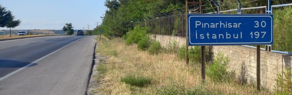
State Highway D020
I now have my plane ticket back to Edinburgh booked, together with The Ven Claude's space in the hold of a Turkish Airlines Airbus A321, so to try to eat up some kilometres, I decided to take the State highway south-east from Kirklareli – the D20 which other cyclists have pronounced safe, if somewhat dull.
Leaving Kirklareli on a cycle track, I picked up the road, which began with a wide hard shoulder to cycle on. After a while this became an 18-inch strip, just enough to tuck into, and for a few kilometres I had to cycle on the carriageway itself. But it is clear that motorist are used to cyclists on this road, and everyone, especially the lorries, gave me a wide berth. Every fifth or sixth car and almost every other lorry tooted in encouragement, which was quite nice, not least because it confirmed they had seen me. At one point, passing the construction of a new road, I decided to cycle on the unmade surface to get away from debris that had fallen onto the existing road. I was just wondering whether it mattered that I was leaving bike tyre tracks on the unfinished surface, when I was stopped by a banksman. I was expecting (and probably deserved) an earful, but instead I got a smiling “Hello, my name's Mehmed, what's your name?” followed by an inquiry about where I'd come from and where I was going and advice to drink plenty of water and where to find it.
It was, actually, a cooler day, thanks to a brisk headwind, but this eventually became a side-wind and an increasing nuisance. It was blowing me away from the traffic rather than into it, but there was a danger of over-correcting. Near the small former Byzantine town of Cakilli, a monbloc path appeared at the roadside, about a foot higher than the road itself, and because of the wind I was pleased to take it despite the annoying surface. Finally I noticed a rough, unpaved farm track running off to the right, and asked the CycleTravel app, which has an encyclopaedic knowledge of the rough unpaved tracks of Europe, whether it might take me to my destination. It did, by a round-about way, and off we bumped. A few minutes later I was paused at a three-way fork between fields of oats, potatoes and sunflowers trying to figure out what the app meant by its instruction “continue on” when a farmer burst through a thicket. In the UK, I am sorry to say, farmers bursting out of thickets to find strangers on heavily-loaded bikes amidst their crops, have been known to use sentences about “my land”. This chap, however, asked “Saray?” and pointed the way, beaming just like Mehmed. I am rapidly coming to the conclusion that the Turks are among the warmest people I've ever met.
I had hoped to get 20 kilometres beyond Saray by close of play, but the wind put paid to that, so I checked into the town's £17-a-night “Elit Hotel” and was just returning from a hearty meal of chicken soup and beef stew at a local cafe, when I bumped into round-the-world cyclist Jacques in the lobby. Jacques, 60, sold his house in France when he was 30 to cycle round the globe, and liked it so much he never stopped. I struggled a bit to take in every detail, but I gathered he's since been round the world three times in each direction, sleeping in a hammock, the only country he's not yet cycled through is Burma, though he's hoping to address that soon, and he was heading home to France for his mother's 80th birthday. Because of his constantly-moving lifestyle, he has to carry a fearful amount of gear, 80 kilos, which makes The Ven.Claud's 30 kilogramme payload a mere bagatelle.


Dogs in Turkey and the Balkans are a concern for some cyclists. One cyclist asked me how to tell if a dog was going to be "threatening or chill". Example, then. This one is "chill". When it eventually removes itself from the centre of this ford on the outskirts of Saray, the rest of us can go on our way
Day 64 Saray to Sazlibosna (112 kms)
I decided to keep away from the D020 state highway completely today because of the continuing high wind, and plotted an alternative course, initially heading for the industrial town of Cerkezkoy, then cycling up onto a high plain, most of which, it appeared, is being used as a vast landfill site. At one point I felt as though I had been overtaken by every bin lorry in Turkey, grinding their way up behind me. The grit road across the plain is dusty, arid, and largely shadeless, and as I crossed it I saw not a single car – just lorries loaded with waste. At one point a kind lorry driver coming the other way stopped, rolled down his window, and checked if I had enough water. Later, near a village called Nakkas, I took a wrong turning, turned back, and saw Frenchman Jacques – the self-styled Cycle Normad – puzzling over the same junction. He'd left the hotel in Saray after me, also trying to avoid the highway for the same reason, and had easily caught up. We talked a while then set off together. The route then proceeded up an extremely long, steep hill, and I knew I was going to be exposed for the weakling I am. Jacques, with his 80 kg load, went up it like a clockwork toy. I tried to bat for Britain, but 30 years on the road have made Jacques a super-human hill climber, so I soon gave up and pushed. So unfair on him, then, that when a van driver stopped a few minutes later and gave me a generous handful of the most delicious plums, Jacques had disappeared over the horizon and never got any. By the way, I've just started to read his blog – it's at www.jacques-sirat.com . Soon after that a sight for sore eyes loomed into view: From the summit, in the far distance, my first sight of my destination – Istanbul!


My first sight of Istanbul
When I arrived at the village of Salzibosna – 30 miles or so from Istanbul as the crow flies-- a big local wedding was in progress. My host, Fikri Bekbas, who'd met me by the square to guide me to his house, asked if I was hungry -- and took me over to the wedding where the cook loaded me a vast, and very welcome, plate of meat and rice.
Day 65 Sazlibosna to the Bosphorous Bridge, Istanbul (Asian end) (66 kms)


The bike on Asian soil at the Bosphorous Bridge, for all the world as good as after a couple of months' commuting to Gleneagles Station
Fikri fixed me a breakfast of bread, olives and cheese to fuel the final leg, and I mapped a route via forest roads via the nearby Sazlidere Reservoir to reduce my exposure to Istanbul traffic. I left all my camping gear at Fikri's to lighten my load, as I will be going back there before I fly out.
My route actually didn't work out, however, as it turns out a huge new flyover is being built above the dam, no doubt to serve the new Istanbul airport, I got caught up in the construction works and had to push uphill through the moonscape. Before that, it was a lovely start to the day. I then wound through the outskirts and then the city itself – Istanbul is a vast metropolis of 16 million people -- avoiding motorways, spaghetti junctions and so forth, and after several hours arrived at the river. I finally picked up a dedicated cycle path – I think Istanbul's only one – which, with a few breaks, took me to the ferry terminal at Eminonu. There I took a 15-minute ferry down the Golden Horn and across the Bosphorous (cyclists are not permitted on the Bosphorous Bridge itself) and completed the final couple of kilometres of my 4198 km (2608 miles) journey on Asian soil to the closest vantage point to the bridge.
On the way I passed numerous bathing spots where men and boys were swimming and sunbathing. No women or girls, however, not even female children. It was quite stark.
I was sorry I didn't finish at the same time as some of those great people I met on the way, and became friends. I enlisted a passing Japanese tourist to take the finishing-line photo, and added a few selfies and a photo of the steel-framed hero itself – the Venerable Claude. The old bike did good – no punctures, no breakdowns, no broken spokes, no broken chain. Maintenance limited to pumping tyres, oiling, tightening nuts, replacement of three sets of brake pads, and the application of fresh duct tape to the rear mudguard.
To those who say cycling in Istanbul city itself is “truly dangerous” (Mark Beaumont among them), I didn't find that to be true. Drivers continued to be careful around me. It was, however, tiresome, required a lot of concentration, and, to be frank, wasn't particularly enjoyable. Istanbul is still not a cycling-friendly city. Indeed, apart from on the few kilometres of the Bosphorous Cycle Path, I did not see a single other cyclist of any sort all day, and that speaks for itself.
The Turks continued to display random acts of kindness. For example, the man who used his own Istanbul Card to open a loo turnstyle for me because I didn't have one. And I when I went looking for a big holdall to consolidate my eight bike bags into one to take on the plane: The shop I went into was selling some very fine designer fakes, but I explained they weren't what I needed. The owner immediately emptied an old holdall of his own that he had under the counter, full of bits and bobs, and refused to take a penny for it.
This is a cycling blog, not a travelogue, so I won't attempt to address all that there is to see in this extraordinary and mysterious city – the calls to prayer, the Hagia Sophia, the Blue Mosque, the city corporation excursion boat down the Bosphorous, the grilled mackerel in bread rolls by the Golden Horn, the Whirling Dervishes, the old tram, the Galeta Tower, and of course lots of ferries that one can ride all day for next to nothing.


With the Venerable Claud, at the Bosphorous Bridge
EPILOGUE


The old bike back home
I stayed in Sazlibosna, a village of about the same size as my home village in Perthshire, while The Ven. Claud was boxed up ready for a middle of-the-night trip to the airport. It was an interesting experience. My host Fikri took me on numerous trips to the local coffee houses, of which there are three, but at which everyone drinks glass after glass of black tea (7.5 TL, or 18 pence, a time) or hot apple juice, rather than coffee, which is expensive. The coffee houses are huge part of village life in which women appear to play little or no part. Men sit at the tea houses, chatting, playing games, often patting each other affectionately in a way you don't see in the UK. I saw no women at the tea houses, though I did ask if it would be OK if a woman were to turn up – to use the Internet for example – and I was told it would be.
Towards the end of my short stay, I was invited to meet the village headman, or “muhtah”, a post dating back to Ottoman times. I waited at the next door tea house until he drew up in a large black car, accompanied by three fit-looking young male assistants. His was the only building I'd been in there that had air conditioning. He sat behind a large teak desk, his name on a nameplate like a magistrate, a picture of Ataturk behind him. He seemed about 40, with higher education – maybe legal, or in real estate. With Fikri interpreting, we discussed Scotland, looked at pictures he found on the Internet of my own village, compared notes about village life, and touched on the difficulty of Turks getting visas, to visit the UK, even as tourists.
It was very hot in Sazlibosna – at least 38 degrees – and I was told this was what they would expect in August, not late June/early July.
I shall remember Sazlibosna from the sound of storks clattering their beaks on their nests,
the calls to prayer from the minaret above the mosque, the sheep being led to and from the pastures at the start and end of the day, bells ringing round their necks, and the common decency I found all around me. I shall also remember the swarms of maddening flies, and the teahouse customers bashing them with plastic swatters. And the street dogs – all nice ones. The day before I left, a team of dog catchers turned up to round up the village strays under a new law, which is proving controversial. The plan is to take them to a pound where they will be re-homed if possible (not much chance of that, though, I fear), destroyed, or, in the most hopeful scenario, neutered and released. I was told they only got one dog because there's a dog society as well as a human one, and word quickly got around and the rest scarpered.
I had a chance to go back through my notes and work out an average daily distance during my trip. I had eight days off – in Cologne, Heidelberg, Vienna, Budapest, Belgrade, Negotin, Sofia, and Edirne – meaning that I actually cycled for 57 days, averaging 73.5 kms (roughly 46 miles) a day.
Of those I met on the way, I know that Carla, Frits and Juli all made it safely to Istanbul to fly home.
What happened to the others I met I don't know – I hope Marvin, for example, for whom Istanbul was only an initial destination, made it there OK and continued his journey safely to wherever he eventually decided.
On the morning of my departure, Fikri, who was anxious I should not miss my flight, woke me at 2.00 am and got me to Istanbul Airport two-and-a-half hours before check-in opened, beating even my wife Helen for allowing what she calls “plenty of time”.Other travellers may wish to be warned that despite the reasonableness of prices in Turkey generally, Istanbul Airport is the most expensive I have ever flown from: A ham and egg roll cost 11 Euros. I saved myself for the excellent in-flight breakfast on the national carrier, Turkish Airlines.
Four-and-a-bit hours later, as we banked over Edinburgh with a view from aeroplane window of the Forth bridges, neither I nor the passenger next to me, who'd been away much longer, could entirely maintain our composure.
Comments